26cm x 33cm
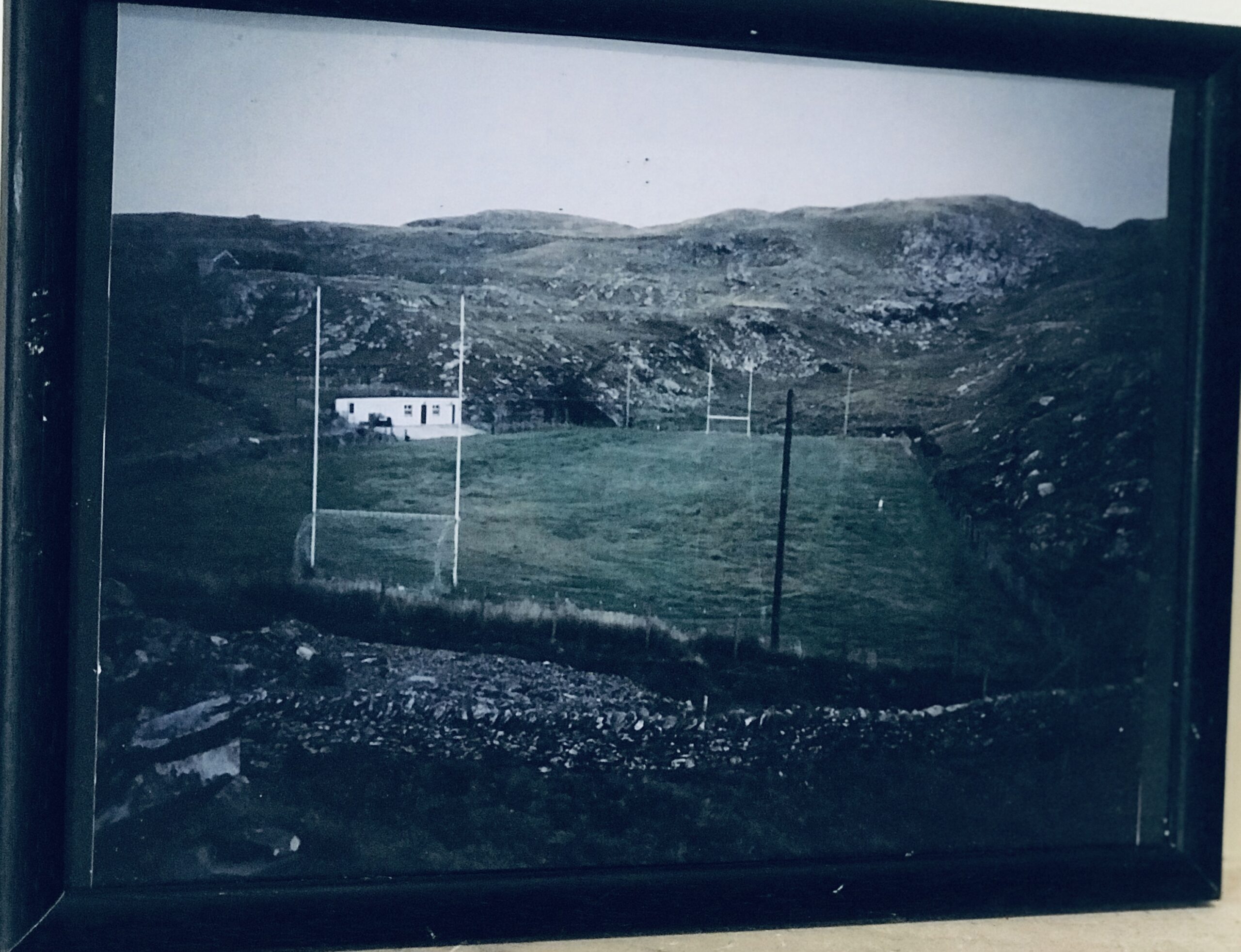
Fantastic shot of the most westerly GAA pitch in Ireland and prob in Western Europe-the pitch on Care Island where the resourceful locals have mangaged to produce a decent playing surface on the only flat patch of land on the island !
Inishturk (Inis Toirc in Irish, meaning Wild Boar Island) is an inhabited island of County Mayo, in Ireland.
Geography

Islands off County Mayo
The island lies about 15 km (9 mi) off the coast; its highest point reaches 189.3 m (621.1 ft) above sea level. Between Inisturk and Clare Island lies Caher Island. It has a permanent population of 58 people.There are two main settlements, both on the more sheltered eastern end of the island, Ballyheer and Garranty. Bellavaun and Craggy are abandoned settlements. The British built a Martello tower on the western coast during the Napoleonic Wars. Inisturk has the highest per capita donation rate towards the RNLI in the whole of Ireland.
History
Inishturk has been inhabited on and off since 4,000 BCE and has been inhabited permanently since at least 1700. Some of the more recent inhabitants are descended from evacuees from Inishark to the southwest. The social club Mountain Common is situated on the hill that separates the two settlements.
Recent history
In 1993 Inishturk Community centre was opened, this community centre doubles as a library and a pub.
In June 2014 the ESB commissioned three new Broadcrown BCP 110-50 100kVA diesel generators to supply electricity to the island The ESB have operated a diesel power station on the island since the 1980s
Inishturk gained international attention in 2016 after a number of websites claimed that the island would welcome any American “refugees” fleeing a potential Donald Trump presidency.These claims were used as one example of the type of “fake news” that arose during the 2016 US presidential election campaign. As of November 2016, no changes to inward migration have been reported.
The island is home to a primary school on the island which in 2011 had only 3 pupils, this believed to be the smallest primary school in Ireland
Demographics
The table below reports data on Inisturk’s population taken from Discover the Islands of Ireland (Alex Ritsema, Collins Press, 1999) and the Censusof Ireland.
|
|
|
||||||||||||||||||||||||||||||||||||||||||||||||||||||||||||||||||||||||||||||||||||
Source: Central Statistics Office. “CNA17: Population by Off Shore Island, Sex and Year”. CSO.ie. Retrieved October 12, 2016.
Transport[edit]Prior to 1997 there was no scheduled ferry service and people traveled to and from the islands using local fishing boats. Since then a ferry service operates from Roonagh Quay, Louisburgh, County Mayo.[13] The pier was constructed during the 1980s by the Irish government, around this time the roads on the island were paved.[14] |
||||||||||||||||||||||||||||||||||||||||||||||||||||||||||||||||||||||||||||||||||||||