Home/The Irish Pub Emporium/The Irish Society Emporium
  • Out of stock
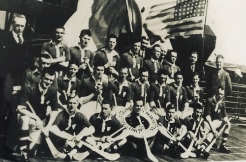
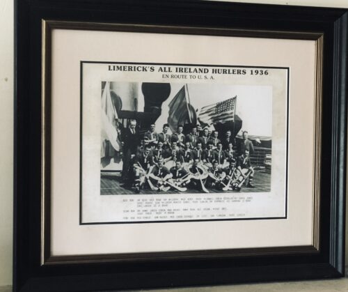
    Extremely rare photograph of the 1936 Limerick Hurlers as they embarked on a tour of the USA after winning the All Ireland. This photo was taken on board a transatlantic liner shows a very happy group setting sail for America where they would be feted as was customary for reigning All Ireland champions. 53cm x 65cm   Castleconnell Co Limerick
    In 1936, the Limerick GAA hurlers took on a New York team at Yankee Stadium.
    British Pathe has shared this amazing footage of the Limerick GAA hurling team taking on the New York-based hurling team on the hallowed grounds of Yankee Stadium in 1936. The historic footage, which unfortunately does not include sound, features the Limerick hurling team posing as a group on the pitch, as well as longshots of the match and the crowds in the grandstands.British Pathe noted that M. Mackey and T. Ryan scored for Limerick, and the final score was 16 points to 9 points, with Limerick as the victors.
     
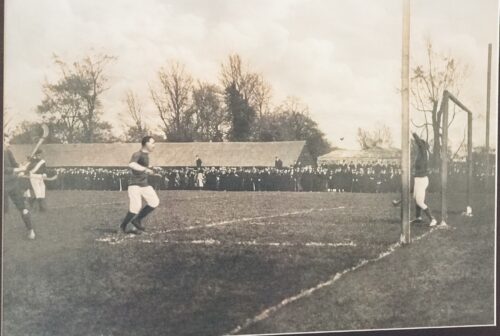
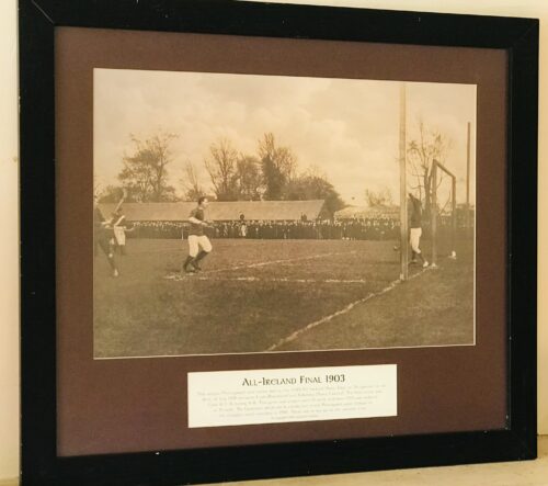
  • 58cm x 67cm    Urlingford Co Kilkenny Unique,large photograph taken of a goalmouth scene during the 1903 hurling final between Cork(represented by Blackrock) and Kilkenny (Three Castles) at Dungarvan Co Waterford.The final result was an emphatic win for the Corkmen  8-9 to 0-8.The game was played with 17 players aside and it was not until 1913 that teams were reduced to the present day 15 a side.The goalposts which can be clearly seen in the photo were changed to the uprights format with crossbar in 1910 which are in use up to the present time.      
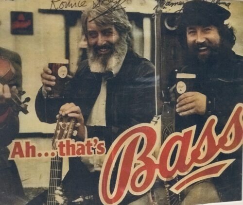
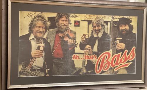
  • 57cm x 75cm   Dublin The Dubliners were quite simply one of the most famous Irish folk bands of all time.Founded in 1962,they enjoyed a 50 year career with the success of the band centred on their two lead singers,Luke Kelly and Ronnie Drew.They garnered massive international acclaim with their lively Irish folk songs,traditional street ballads and instrumentals eventually crossing over to mainstream culture by appearing on Top of the Pops in 1967 with "Seven Drunken Nights" which sold over 250000 singles in the UK alone.Later a number of collaborations with the Pogues saw them enter the UK singles charts again on another 2 occasions.Instrumental in popularising Irish folk music abroad ,they influenced many generations of Irish bands and covers of Irish ballads such as Raglan Road and the Auld Triangle by Luke Kelly and Ronnie Drew tend to be regarded as definitive versions.They also enjoyed a hard drinking and partying image and this advertising collaboration with Bass Ales must be seen as the perfect fit in terms of a target audience !  
  • Another beautiful example of the joint Tourism-Irish whiskey adverts Jameson ran in the 1950s and  1960s,depicting a romantic vision of the "Auld country",its scenic sights and the promise of a glass of Jameson to celebrate a days sightseeing. 60cm x 80cm.    Athboy Co Meath John Jameson was originally a lawyer from Alloa in Scotland before he founded his eponymous distillery in Dublin in 1780.Prevoius to this he had made the wise move of marrying Margaret Haig (1753–1815) in 1768,one of the simple reasons being Margaret was the eldest daughter of John Haig, the famous whisky distiller in Scotland. John and Margaret had eight sons and eight daughters, a family of 16 children. Portraits of the couple by Sir Henry Raeburn are on display in the National Gallery of Ireland. John Jameson joined the Convivial Lodge No. 202, of the Dublin Freemasons on the 24th June 1774 and in 1780, Irish whiskey distillation began at Bow Street. In 1805, he was joined by his son John Jameson II who took over the family business that year and for the next 41 years, John Jameson II built up the business before handing over to his son John Jameson the 3rd in 1851. In 1901, the Company was formally incorporated as John Jameson and Son Ltd. Four of John Jameson’s sons followed his footsteps in distilling in Ireland, John Jameson II (1773 – 1851) at Bow Street, William and James Jameson at Marrowbone Lane in Dublin (where they partnered their Stein relations, calling their business Jameson and Stein, before settling on William Jameson & Co.). The fourth of Jameson's sons, Andrew, who had a small distillery at Enniscorthy, Co. Wexford, was the grandfather of Guglielmo Marconi, inventor of wireless telegraphy. Marconi’s mother was Annie Jameson, Andrew’s daughter. John Jameson’s eldest son, Robert took over his father’s legal business in Alloa. The Jamesons became the most important distilling family in Ireland, despite rivalry between the Bow Street and Marrowbone Lane distilleries. By the turn of the 19th century, it was the second largest producer in Ireland and one of the largest in the world, producing 1,000,000 gallons annually. Dublin at the time was the centre of world whiskey production. It was the second most popular spirit in the world after rum and internationally Jameson had by 1805 become the world's number one whiskey. Today, Jameson is the world's third largest single-distillery whiskey. Historical events, for a time, set the company back. The temperance movement in Ireland had an enormous impact domestically but the two key events that affected Jameson were the Irish War of Independence and subsequent trade war with the British which denied Jameson the export markets of the Commonwealth, and shortly thereafter, the introduction of prohibition in the United States. While Scottish brands could easily slip across the Canada–US border, Jameson was excluded from its biggest market for many years.
    Historical pot still at the Jameson distillery in Cork
    The introduction of column stills by the Scottish blenders in the mid-19th-century enabled increased production that the Irish, still making labour-intensive single pot still whiskey, could not compete with. There was a legal enquiry somewhere in 1908 to deal with the trade definition of whiskey. The Scottish producers won within some jurisdictions, and blends became recognised in the law of that jurisdiction as whiskey. The Irish in general, and Jameson in particular, continued with the traditional pot still production process for many years.In 1966 John Jameson merged with Cork Distillers and John Powers to form the Irish Distillers Group. In 1976, the Dublin whiskey distilleries of Jameson in Bow Street and in John's Lane were closed following the opening of a New Midleton Distillery by Irish Distillers outside Cork. The Midleton Distillery now produces much of the Irish whiskey sold in Ireland under the Jameson, Midleton, Powers, Redbreast, Spot and Paddy labels. The new facility adjoins the Old Midleton Distillery, the original home of the Paddy label, which is now home to the Jameson Experience Visitor Centre and the Irish Whiskey Academy. The Jameson brand was acquired by the French drinks conglomerate Pernod Ricard in 1988, when it bought Irish Distillers. The old Jameson Distillery in Bow Street near Smithfield in Dublin now serves as a museum which offers tours and tastings. The distillery, which is historical in nature and no longer produces whiskey on site, went through a $12.6 million renovation that was concluded in March 2016, and is now a focal part of Ireland's strategy to raise the number of whiskey tourists, which stood at 600,000 in 2017.Bow Street also now has a fully functioning Maturation Warehouse within its walls since the 2016 renovation. It is here that Jameson 18 Bow Street is finished before being bottled at Cask Strength. In 2008, The Local, an Irish pub in Minneapolis, sold 671 cases of Jameson (22 bottles a day),making it the largest server of Jameson's in the world – a title it maintained for four consecutive years.  
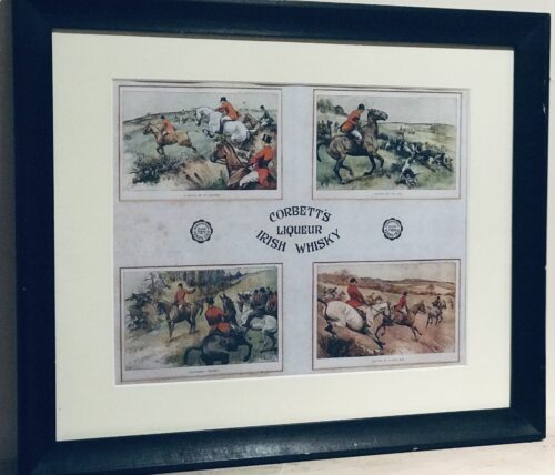
  • Corbetts Liqueur Irish Whiskey is a long defunct brand that was distilled in Coleraine Co Antrim.This delightful and quaint advert depicts the thrills and spills of a hard  days hunting which was inevitably punctuated by plenty of swigs from whiskey containing hip flasks. 45cm x 55cm  Ballymena Co Antrim
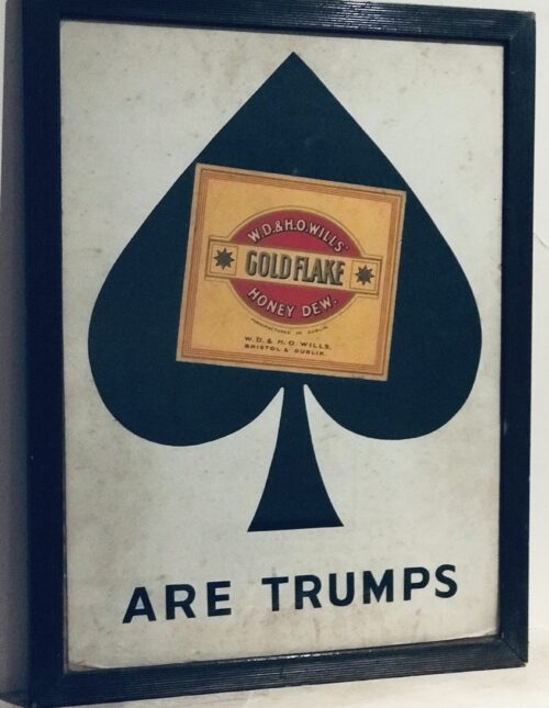
  • Original and classic  Gold Flake are Trumps Show Card advert. 58cm x 44cm  Bray Co Wicklow Starting off as a cigarette with a heritage, Gold Flake was produced by the Bristol and Dublin factories  of W.D. & H.O. Wills, from 1901 as part of Imperial Tobacco. "Gold flake" refers to cigarettes made using bright rich golden tobacco. After 1912, the biggest change in the brand was in 1971 with the introduction of Gold Flake Kings, followed up with the launch of Gold Flake Kings Lights in 1999 The initial ads positioned the cigarette as a companion.  It was meant to be a cigarette for the elite and the rich –  It did not differentiate itself specifically from other brands. Advertising emphasized this comparison to gold. The statement "For the gracious people" summed the core of the brand. After the introduction of lights as a category, the brand introduced the positioning of Honeydew Smooth – giving the brand a recognizable differentiator, this positioning was backed by the dew drop symbol. With smoothness being the biggest claim the brand used symbols like the silk scarf, feather, paint brush, violin, marble vase, hour glass, and shell as visuals to reiterate and associate back with smoothness. After this, the brand reinvented its image and positioning with a new campaign that moved away from the well-established Honeydew campaign. This was the Go smooth campaign. The campaign was successful in connecting to the Gold Flake consumer and retaining the long-standing loyalty.Many poster advertisements have been made for Gold Flake cigarettes,including the Gold Flake are Trumps as seen here.In the early 1900s, two characters by the names of "Mr Gold" and "Mr Flake" were introduced to promote the Gold Flake brand in the United Kingdom. The characters were used for about 30 years and were popular, but it did not help the sales of the brand and Gold Flake was discontinued for a short period of time.From a marketing perspective ,Gold flake  still differentiated itself on the purity and quality of its experience. The brand stood for a celebratory attitude.   
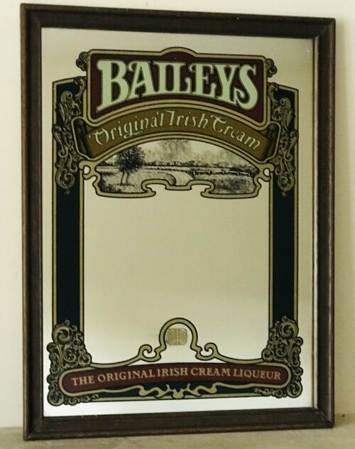
  • Beautiful,nicely proportioned  Baileys Irish Cream Pub Mirror.  45cm x 55 cm Baileys Irish cream is an Irish whiskey and cream-based liqueur, made by Diageo at Nangor Road, in Dublin, Republic of Ireland and in Mallusk, Northern Ireland owned by Gilbeys of Ireland, the trademark is currently owned by Diageo. It has a declared alcohol content of 17% by volume. Baileys Irish Cream was created by Tom Jago of Gilbeys of Ireland, a division of International Distillers & Vintners, as it searched for something to introduce to the international market. The process of finding a product began in 1971 and it was introduced in 1974 as the first Irish cream on the market. The Baileys name was granted permission by John Chesterman after Gilbeys asked to use the name from a restaurant that John Chesterman owned. The fictional R.A. Bailey signature was inspired by the Bailey's Hotel in London, though the registered trademark omits the apostrophe.

    Cream and Irish whiskey from various distilleries are homogenized to form an emulsion with the aid of an emulsifier containing refined vegetable oil. The process prevents the separation of alcohol and cream during storage. Baileys contains a proprietary cocoa extract recipe giving Baileys its chocolate character and essence. The quantity of other ingredients is not known but they include herbs and sugar. According to the manufacturer, no preservatives are required as the alcohol content preserves the cream. The cream used in the drink comes from Glanbia, an Irish dairy company. Glanbia's Virginia facility in County Cavan produces a range of fat-filled milk powders and fresh cream. It has been the principal cream supplier to Baileys Irish Cream Liqueurs for more than thirty years. At busier times of the year, Glanbia will also supply cream from its Ballyragget facility in Kilkenny.

    The manufacturer claims Baileys Irish Cream has a shelf life of 24 months and guarantees its taste for two years from the day it was made—opened or unopened, stored in a refrigerator or not—when stored away from direct sunlight at temperatures between 0 and 25 °C (32 and 77 °F).

    Baileys and coffee
    Baileys cheesecake served with a Baileys-and-chocolate sauce on the side
      As is the case with milk, cream will curdle whenever it comes into contact with a weak acid. Milk and cream contain casein, which coagulates, when mixed with weak acids such as lemon, tonic water, or traces of wine. While this outcome is undesirable in most situations, some cocktails (such as the cement mixer, which consists of a shot of Bailey's mixed with the squeezed juice from a slice of lime) specifically encourage coagulation. In 2003, Bailey & Co. launched Baileys Glide, aimed at the alcopop market. It was discontinued in 2006. In 2005, Baileys launched mint chocolate and crème caramel variants at 17% ABV. They were originally released in UK airports and were subsequently released in the mass markets of the UK, US, Australia and Canada in 2006. In 2008, Baileys, after the success of previous flavour variants, released a coffee variant, followed by a hazelnut flavoured variant in 2010.The company trialled a new premium variety, Baileys Gold, at several European airports in 2009. The Gold version also was marketed towards the Japanese consumer.The latest additions to the Baileys flavour family are Biscotti, launched in 2011, and a sub-brand premium product Baileys Chocolat Luxe, which combined Belgian chocolate with Baileys, in 2013. The company released a Vanilla-Cinnamon variety in the US market in 2013 with further flavours, Pumpkin Spice, Espresso and Salted Caramel launching the following year.In 2017, Baileys launched their Pumpkin Spice flavoured liqueur, also their Vegan-Friendly Baileys Almande, and in 2018 Baileys Strawberries & Cream was made available.  
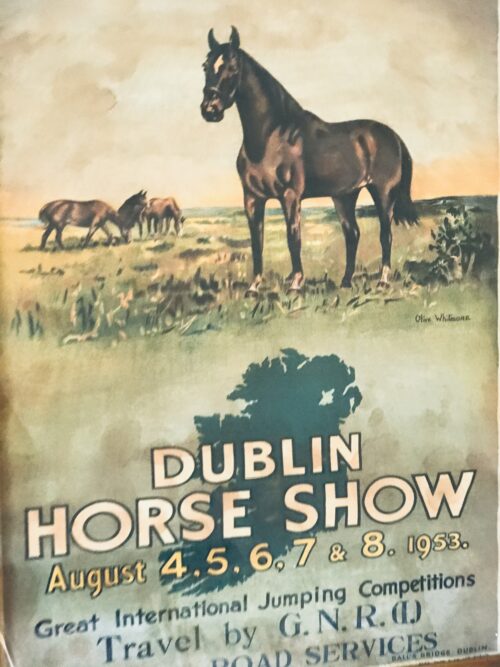
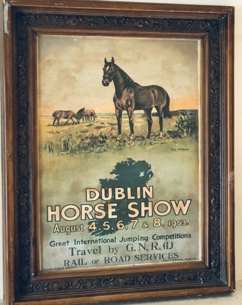
  • 65cm x 52cm     Naas Co Kildare RDS (Royal Dublin Society) Dublin Horse Show advertising print from August 1953 featuring a beautiful painting depicting horses at pasture by the artist Olive Whitmore.The advert was printed by  Alex Thom & Co Ltd Dublin  and also describes the various modes of transport available to prospective horseshow goers, namely the GNR or Great Northern Railway. This print is available as a high quality reproduction with an antique frame.For price details on the original ,please email us directly at irishpubemporium@gmail.com Founded in 1876,the GNR was a merger between the Irish North Western Railway,Northern Railway of Ireland and Ulster Railway.The company was nationalised later in 1953 before being finally liquidated 5 years later with its assets divided upon national lines between the Ulster Transport Authority & Ćoras Iompair Éireann (CIE). The first Dublin Horse Show took place in 1864 and was operated in conjunction with the Royal Agricultural Society of Ireland. The first solely Society-run Horse Show was held in 1868 and was one of the earliest "leaping" competitions ever held.Over time it has become a high-profile International show jumping competition, national showing competition and major entertainment event in Ireland. In 1982 the RDS hosted the Show Jumping World Championshipsand incorporated it into the Dublin Horse Show of that year. The Dublin Horse Show has an array of national & international show jumping competitions and world class equestrian entertainment, great shopping, delicious food, music & fantastic daily entertainment. There are over 130 classes at the Show and they can be generally categorised into the following types of equestrian competitions: showing classes, performance classes and showjumping classes.

    • The first show was held in 1864 under the auspices of the Society, but organised by the Royal Agricultural Society of Ireland.
    • There were 366 entries in the first Show with a total prize fund of £520.
    • On the 28, 29 and 30 July 1868 the first show was held and organised by the Royal Dublin Society on the lawns of Leinster House. The Council granted £100 out of the Society's funds to be awarded in prizes. It started as a show of led-horses and featured ‘leaping' demonstrations.
    • The first prize for the Stone Wall competition (6ft) in 1868 was won by Richard Flynn on hunter, Shane Rhue (who sold for £1,000 later that day).
    • Ass and mule classes were listed at the first show!
    • In 1869 the first Challenge Cup was presented for the best exhibit in the classes for hunters and young horses likely to make hunters.
    • In 1870 the Show was named ‘The National Horse Show', taking place on the 16-19 August. It was combined with the Annual Sheep Show organised by the Society.
    • 1869 was the year ‘horse leaping' came to prominence. There was the high leap over hurdles trimmed with gorse; the wall jump over a loose stone wall of progressive height not exceeding 6 feet; and the wide leap over 2 ½ ft gorse-filled hurdle with 12 ft of water on the far side.
    • The original rules for the leaping competitions were simply ‘the obstacles had to be cleared to the satisfaction of the judges'.
    • The prizes for the high and wide leaps were £5 for first and £2 for second with £10 and a cup to the winner of the championship and a riding crop and a fiver to the runner up.
    • In 1881 the Show moved to ‘Ball's Bridge', a greenfield site. The first continuous ‘leaping' course was introduced at the Show.
    • In 1881 the first viewing stand was erected on the site of the present Grand Stand. It held 800 people.
    • With over 800 entries in the Show in 1895, it was necessary to run the jumping competitors off in pairs - causing difficulties for the judges at the time!
    • Women first took part in jumping competitions from 1919.
    • A class for women was introduced that year on the second day of the Show (Wednesday was the second day of the Show in 1919. Ladies' Day moved to Thursday, the second day, when the Show went from six to five days). Quickly after that, from the 1920s onwards, women were able to compete freely in many competitions at the Show.
    • Women competed in international competitions representing their country shortly after WWII.
    • As the first "Ladies' Jumping Competition" was held on the second day of the Show this day become known as Ladies' Day. A name that has stuck ever since.
    • In 1925 Colonel Zeigler of the Swiss Army first suggested holding an international jumping event. The Aga Khan of the time heard of this proposal and offered a challenge trophy to the winner of the competition.
    • In 1926 International Competitions were introduced to the show and was the first time the Nations' Cup for the Aga Khan Challenge trophy was held.
    • Six countries competed in the first international teams competition for the Aga Khan Challenge trophy - Great Britain, Holland, Belgium, France, Switzerland and Ireland. The Swiss team won the title on Irish bred horses.
    • The Swiss team won out the original trophy in 1930. Ireland won the first replacement in 1937 and another in 1979, Britain in 1953 and 1975. The present trophy is the sixth in the series and was presented by His Highness the Aga Khan in 1980.
    • Up until 1949 the Nations' Cup teams had to consist of military officers.
    • The first Grand Prix (Irish Trophy) held in 1934 was won by Comdt.J.D.(Jed) O'Dwyer, of the Army Equitation school. The Irish Trophy becomes the possession of the rider if it is won three times in succession or four times in all.
    • The first timed jumping competition was held in 1938. In 1951 an electric clock was installed and the time factor entered most competitions.
    • In 1976, after 50 years of international competition, the two grass banks in the Arena were removed so the Arena could be used for other events. The continental band at the western end of the Main Arena was added later.
    • Shows have been held annually except from 1914-1919 due to WW1 and from 1940-1946 due to WW2.
    • In 2003 the Nations Cup Competition for the Aga Khan Trophy became part of the Samsung Super League under the auspices of the Federation Equestre Internationale.
    • The Nations Cup Competition for the Aga Khan Trophy is part of the Longines FEI Jumping Nations Cup™ Series.
    • The Dublin Horse Show is Ireland's largest equestrian event, and one of the largest events held on the island.
    • The Show has one of the largest annual prize pools for international show jumping in the world.
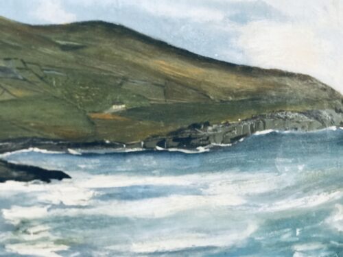
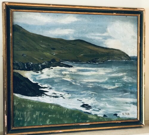
  • 65cm x 75cm    Caherciveen Co Kerry Stunning & imposing original oil painting depicting the Wild Atlantic coastline Co Kerry.In this case the part of the coastline featured is near The Glen or St Finians Bay between Ballinskelligs and Port Magee on the Beara Peninsula where there are absolutely magnificent,uninterrupted views of the Skellig Islands . The artist is RC Duffield  .The current frame is need of replacing and will be completed before sale/shipping to the purchasers  satisfaction.  

    The Glen / St Finians Bay

    St. Finan’s Bay commonly called (The Glen) stretches from Duchalla head in the south to Puffin Island in the north encompassing Skellig rocks and the lemon. The area got its name from St. Finian, a man who lived in the 10th century and travelled from Skelligs to Keel frequently to say mass. He had a monastery at Keel but the area is much older than that era. There is evidence of habitation from the bronze age and there are many soubterrains, galtans and the remains of an earthen fort at Rathkerin. The Glen is also a well known surfer’s paradise, St Finian’s Bay in The Glen has the smallest beach with the strongest rip tides, but often has the best waves. Not a place for the beginner, you need to be able to read the water well, but for the more experienced boarder it can be a thrill. HISTORY AND ARCHAEOLOGY The area is probably best known for its christian or ecclesiastical sites. The root word keel (cill) meaning church is common. Kilaboona Oratory is an  early Christian site located to the west of the settlement there is a well dedicated to St. Buaine. The medieval church at keel was built near the site of St. Finans monastery and was the parish church for the glen and portmagee for centuries. To the South of the church is a “Pagan’s Grave”, an enclosure of standing stones, 18ft x 11ft. In ballynabloun stands templecashel oratory a small church which was said to be used by nuns. Nearby is a walled kitchen garden on an acre of ground built by the o’connell landlords in 1831. Keelonecaha is another holy site and it is said there was a fight between the irish and the danes there. Evidence of habitation has been found dating from the Bronze Age and there are  the remains of a fort at Rathkerin. Many of the heritage sites have spellbinding views of the Skellig Rocks. Some more Christian sites include an Aifrinn,which is a ‘Mass Rock‘ used in Penal times this can be found in the town land of Aghort , another interesting site is Dún Canuig Promontory  in the town land of Cloghanecanuig. FLORA AND FAUNA There is an abundance of plant life here due to it mild climate. Flowers include buttercup, primrose, daisy, bluebell, spurge, great celadineand orchid. The fuchsia and hawthorn add colour and scent to the ditches in summer and the montbretia with its orange flowers decorate the roadsides. Birds are plentiful here too from the small, which include the wren, robin, yellowhammer, stonechat, wagtail to the large seabirds including all species of gull from, heron, curlew, cormorant, razorbill and gannet. Puffin island is a bird sanctuary which gives protection to all seabirds including the beautiful puffins. There are many varieties of fish in the bay like pollack, mackerel, wrasse, cod, haddock, lobster, cray and crab. To enjoy the beauty one needs to walk through out the glen. Parking the car at the beach one can walk south towards ducalla, north towards glenaragh or east to killabuonia. These walks are signposted. Panoramic views can be had from com an easboig in the north and from the tower in bolus in the south. To sweeten your walk there is also a chocolate factory close to the beach which provides hand made chocolate. Just don’t drive through – stop and take in the scenery and walk or cycle.  
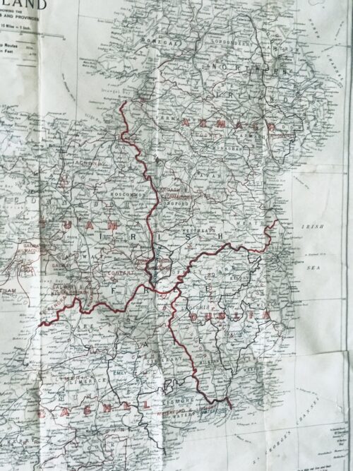
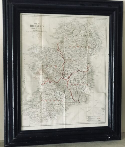
  • Superb 1940s era vintage original map showing the dioceses(!) and provinces of Ireland published by J.Duffy & Co.Ltd Westmoreland St Dublin. James Duffy (1809 – 4 July 1871) was a prominent Irish author and publisher. Duffy's business would become one of the major publishers of Irish nationalist books, bibles, magazines, Missals and religious texts throughout the 19th and 20th centuries. He was also a major publisher of Irish fiction.[1] He was described as having "invented a new kind of cosy family Catholicism. Duffy was born in Monaghan. He was educated at a hedge school and began his business as a bookseller through purchasing Protestant bibles given to Catholics. He then traveled to Liverpoolwhere he traded them for more valuable books. In 1830 he founded his own company, James Duffy and Sons and issued Boney's Oraculum, or Napoleon's Book of Fate, which experienced huge sales. Boney's Oraculum would later be the object of an allusion in a speech of Capt. Boyle in Seán O'Casey's 1924 play Juno and the Paycock. Another great editorial success was achieved when he collaborated with Charles Gavan Duffy (no relation) from 1843 to 1846 to publish poetry from the writers of The Nation. By the 1860s he was employing 120 staff members at his various enterprises in Dublin.[4] In 1860 he started Duffy's Hibernian Magazine, edited by Martin Haverty. It was a monthly, price eight pence, and ran for two years. The contributors included Charles Patrick Meehan, Julia Kavanagh, Denis Florence MacCarthy, John O'Donovan, William Carleton, Thomas D'Arcy McGee, and William John Fitzpatrick, and the articles were all signed. A second series began in 1862, renamed Duffy's Hibernian Sixpence Magazine, with Meehan as editor, which extended to six volumes and ended in June 1865. These and other relatively cheap magazines took advantage of the new-found confidence in home-grown literature and also offered an outlet for Irish authors. Among the magazines he published were:
    • Duffy's Irish Catholic Magazine (1847)
    • Catholic Guardian
    • Christian Family Library
    • Duffy's Hibernian Magazine
    • Illustrated Dublin Journal
    • Duffy's Fireside Magazine: A Monthly Miscellany (November 1850 – October 1852) (price: 4d)
    • Duffy's Hibernian Sixpence Magazine (ceased publication in 1864)
    Duffy's magazines are seen as a forerunner of Ireland's Own today. Among books he published were:
    • The Spirit of the Nation. Ballads and Songs by the Writers of The Nation, with Original and Ancient Music (1845)
    • The Poetry of Ireland. Further collections from the writers of The Nation (1845-1846)
    • The Ballad Poetry of Ireland
    • The Book of Irish Ballads
    • an 1861 edition of the Douay Bible, a copy of which is owned by the Central Catholic Library in Dublin
    • John O'Hart, Irish landed gentry: when Cromwell came to Ireland (Dublin: James Duffy & Sons, 1887)
    • John O’Hanlon, Lives of the Irish Saints, Vol 6 (James Duffy and Sons, 1891)
    • Gerald Griffin The Invasion (Dublin, James Duffy & Sons)
    The publishing house was based at 7 Wellington Quay, Dublin, and later at 14 & 15 Wellington Quay. James Duffy and Co. Ltd. of 38 Westmoreland Street was still in business in the late 20th century.   HISTORY OF MAPPING IN IRELAND: Before the Ordnance Survey undertook the mapping of the country from Malin to Mizzen in the 1830s, cartography, surveying and landscape map production in Ireland were essentially a private undertakings. There had been a seventeenth-century precedent for state involvement in mapping in the various plantation surveys, but after Sir William Petty’s Down Survey (Fig.1) and the more or less final allocation of landed estates in the 1690s, there was no more  central goverment involvement. Throughout the eighteenth century, competition in an expanding market for estate surveys produced a flowering of cartographic enterprise which has added considerably to our understanding of pre-famine social and economic development. This explosion in estate maps, characterised by John Andrews as the ‘golden age of the Irish land surveyor’, was very much a reflection of agriculture-related economic expansion, the development of rural industry and the growth of settlement and landscape embellishment, which has for long been characterised in Europe as the ‘age of improvement’. Though interpretations of the period differ in focus, the landed estate became the principal agency through which economic and social change was mediated throughout the Irish landscape. As with most generalisations, this interpretation may mislead—estates varied enormously in size; many owners were non-resident either on their properties or in Ireland; and there were great contrasts in management order on different estates—but it is a useful model nonetheless.
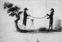
    Fig.2 The chain and circumferentor were still the main tools of the trade in the 1750s.(Courtesy of the National Library of Ireland)

    Fig.2 The chain and circumferentor were still the main tools of the trade in the 1750s. (Courtesy of the National Library of Ireland)

    Rival surveyors Ornamentation and embellishment of estates, especially from the middle of the eighteenth century, employed an expanding army of architects, landscape gardeners, painters, stuccadores, agriculturists, as well as lawyers and agents. Included with these personnel were surveyors and cartographers commissioned by landowners to produce maps both functional and ornamental for the estate office or the drawing room. Indeed later in the century, in the demographic scramble for land, surveyors were frequently also engaged by both owners and tenants to ‘squeeze’ a few more acres out of estate or farm. So active was the market that surveyors vied with each other in producing the most accurate maps. Many of their disputes were personal and public. In the middle of the century, Joshua Wight was called a dunce by a rival. As early as 1716, William Starrat knew that his calculation of forty acres for Inishmakill townland in Fermanagh would ‘be disputed, because Mr Moore’s survey made it only eighteen acres; and besides it is the opinion of a great many that knows the island that it contains about twenty acres. As for Mr Moore’s account, there is no ground for depending on it, because he only viewed it from the mainland and no man can measure an irregular plain at a distance.’ The number of surveys increased as the eighteenth century progressed reflecting expanding estate income and rural economic activity. As with architects and landscape designers, there was a community of surveyors distinguished from each other by their talents, reflected in turn by their fees. Their work ranged from modest, even mediocre and poor surveys, which were poorly realised and often inaccurate, to superlative and innovative productions of great beauty and accuracy. Presumably smaller, less well-off proprietors could only afford the more mediocre efforts. ‘Country surveyors’ worked at local level producing surveys for tenant farmers, assisting with bog divisions, laying out the lines for new roads. The best cartographers like John Rocque and Bernard Scalé were engaged by great landowners like the Duke of Leinster or the Marquis of Downshire. Chain and circumferentor Surveying throughout the eighteenth century occurred against a background of practice inherited from the seventeenth where land had been let by townland. Townland boundary delineation and calculation of townland acreage thus became the main preoccupations of surveyors. The internal geography of townlands was of limited interest to landowners and thus to surveyors, much to the frustration of later historians. Surveyors were seldom innovative; Petty’s style of mapping overshadowed eighteenth-century surveys. Indeed he remained dominant in most theoretical and practical aspects of surveying and little changed in its understanding for a century after him—the chain and circumferentor were still the main tools of the trade in the 1750s (Fig.2). The chain was used for horizontal measurements. The circumferentor was a somewhat obsolete instrument used for plotting angles. Apart from a frequent lack of standardisation in instruments, there was also a regional variation in units of measurement: Irish, plantation and English acres (and perches) were in use, though by the end of the century surveyors increasingly provided measurements in both Irish and statute acres. One of the earliest innovators was Thomas Raven, who had worked with the Ulster plantation producing some fine maps to accompany surveys of the new settlements. Later on he produced estate maps for a number of landowners in Munster and Connacht. The Earl of Essex engaged him to produce a survey of his lands in Farney in south Monaghan which provide a unique glimpse of this Gaelic and slightly planted landscape in 1634 (Fig.3). His maps, in atlas format, show tates (modern townlands) together with more than 400 hundred cabins and houses, wells, mills, churches, as well as indications of land quality within the townland units. Unforunately this amount of detailing of local landscapes did not continue as standard practice with Irish surveyors in the eighteenth century . Boundaries Surveys were undertaken for many reasons—to accompany the sale of property, the settlement of disputes, succession to the estate, leasing of holdings or the introduction of new management. The principal objective of the surveys was to determine the extent of the property in terms of boundaries or areal extent, with a sometimes secondary purpose of measuring land quality. In the later seventeenth and early eighteenth centuries, disputes about land boundaries frequently occurred between landowners—a throwback to the hastily completed surveys of the plantation periods. Raven’s map of Farney, for instance, contains a number of boundaries on the northern limits of the estate marked ‘in controversie’. These disputes were generally settled by survey and agreement. Interestingly later in the eighteenth century and into the nineteenth, the focus of disagreement on boundaries moved from estate to farm level, with frequent disputes arising between tenants and their neighbours or landlords. The burning of land after cropping was an opportune time for measurement. Landowners were frequently called in to adjudicate between disputing tenants who often employed local surveyors to advance their case. Before the establishment of fixed hedges, there were many opportunities for disputes. Starrat’s surveys in the 1730s in the Fermanagh and Leitrim refer to the difficulites of selecting definitive bearings. In the rapid population expansion of the late eighteenth century, landlords often employed surveyors to lay out enclosures. For example, in the 1820s Shirley in Monaghan was engaged in laying out new field boundaries and in persuading his tenantry to plant quicksets. More often than not the lines of main hedges were laid down by the estate surveyor, with the tenant given freedom to subdivide their farms themselves. Frequently tenants employed local surveyors to help with this.
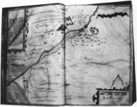
    Fig.3 Carrickmacross, from Thomas Raven's survey of Essex estate, County Monaghan 1634-5. Note the cluster of cabins, center right. (Courtesy of Marquis of Bath)

    Fig.3 Carrickmacross, from Thomas Raven’s survey of Essex estate, County Monaghan 1634-5. Note the cluster of cabins, center right. (Courtesy of Marquis of Bath)

    Rents and leases The falling in of leases in many parts of the country throughout the eighteenth century often revealed to the landowner extensive layers of subtenants who had fractured the land into smaller farms and enclosures. These were frequently taken on as tenants under the head landlord and their farms surveyed and mapped. Maps by Bernard Scalé of the Bath estate in Monaghan and the Devonshire estate in Waterford (Fig.4) were commissioned in the 1770s to assess the nature of change in settlement. In many cases, leases were granted at irregular intervals and landowners had to wait the falling-in of each lease. Great estate owners like Bath, Devonshire or Downshire would, however, undertake a complete survey of their estate and subsequently try to lease out most of their property in one letting. The more common practice, however, was to have individual farm surveys or portions of estates mapped. Also, agricultural development meant re-valuation of land: typically, drainage and wasteland reclamation in the later eighteenth century called for map and rent revisions. In these instances surveyers with their chains and painted pegs were unpopular with tenants who saw them as precursors of rent increases. In prefamine decades, their every move in the countryside was closely watched as the overcrowded acres, roods and perches, were meticulously measured out. John Rocque From the middle of the eighteenth century especially, estate improvements frequently involved extravagant investment in the landowner’s private gardens and demesnes. Elaborate maps of these were often produced to match the picturesque views frequently commissioned from fashionable painters. The maps of John Rocque probably represent the most artistic achievement of a cartographer in eighteenth-century Ireland. Rocque (c.1705-1762) was a member of the French Huguenot community in England who established a reputation as a superlative cartographer, with highly-regarded surveys of London, Paris and Rome to his credit. He was invited to Ireland by a number of Irish noblemen in 1754, mainly with the objective of undertaking a survey of Dublin. This he accomplished in 1756 and his map remains an unsurpassed record of Georgian Dublin (a fragment of which was reproduced on the old £10 note). Rocque was to revolutionise cartography and surveying in Ireland in the space of six years in the 1750s, so much so that in the 1820s, surveyors in Ireland were still being described as belonging to ‘the French school of Rocque’. The hallmark of his cartography was an unprecedented amount of fine detail on the cities and landscapes he mapped. His surveys were carried out by a small team of apprentices who helped to transmit Rocque’s ideas and techniques to the following generations of Irish surveyors. His most notable pupil and successor was Bernard Scalé, who established himself as a well known surveyor in the later eighteenth century (Fig.4). While Rocque was producing the printed surveys of Dublin and other Irish towns, he was also engaged by a number of Irish landlords to map their estates. His most important patron was the twentieth Earl of Kildare (later first Duke of Leinster) who lived at Carton outside Maynooth, and who owned 67,000 acres in a number of manors scattered throughout County Kildare. At the time of the survey (1757), Lord and Lady Kildare were in the process of radically transforming their house and environs in Maynooth. The architect Richard Castle (responsible for designing numerous great houses throughout Ireland) was involved in the remodelling of Carton. The Francini brothers were engaged to decorate the ceilings. So it is a tribute to Rocque’s exceptional reputation that he was involved with some of the most famous and fashionable artists and craftsmen in the transformation of Carton into one of the foremost palladian mansions in the country.
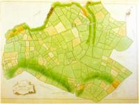
    Fig.4 The manor of Tallow 1774 - part of Bernard Scale's survey of County Waterford's Devonshire estates.(Courtesy of the Trustees of the Chatsworth Settlement)

    Fig.4 The manor of Tallow 1774 – part of Bernard Scale’s survey of County Waterford’s Devonshire estates. (Courtesy of the Trustees of the Chatsworth Settlement)

    Kildare estates The survey of the Kildare estates was produced in eight atlas volumes, each page containing individual maps of the townlands. This set of maps was subsequently dispersed and the maps of Maynooth Manor are currently held in the University Library, Cambridge. A recently-discovered wall map of Maynooth Manor now hangs in Maynooth College. Apart from minor details, it is essentially a replica, drawn on a large sheet, of the album format and may have been produced by Rocque as a working map for the estate office or as a decoration for the house at Carton. The Maynooth map is very characteristic of Rocque—showing the landscape almost as it might have looked from the air. It contains typical detail such as the cartouche with a view of Maynooth Castle. There is wide-ranging detail provided in each townland. Relief is shown by hachures in grey, water (including ditches) by a blue wash. Buildings are shown in block plan—a Rocque innovation—contrasting with earlier, more impressionistic pictorial conventions for buildings. In some of these, the farmyards containing hay or straw stacks are shown. Arable land is usually brown with stippling to represent ridges or furrows, though the full meaning of his code of symbols is still a mystery. Meadow and pasture are shown in light green. Tree symbols show orchards and woodlands; hedges are depicted by lines of bushes. In some areas, fences without hedging are shown by means of a grey herring-bone device. There are also springs, mills, quarries, forges, pigeon houses, prehistoric forts and field names. Each field is numbered in sequence within each townland, and details of the area, and sometimes the content of the field, are given in the reference panel.
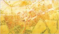
    Fig.5 The town of Maynooth, County Kildare, from John Roque's 1757 survey.(Courtesy of Patrick's College, Maynooth)

    Fig.5 The town of Maynooth, County Kildare, from John Roque’s 1757 survey. (Courtesy of Patrick’s College, Maynooth)

    Landscape embellishment The Carton section of the map shows clearly the demesne landscape as it was emerging from its reorganisation by Lady Kildare. As daughter of the Duke of Richmond she was well connected in England. ‘Capability’ Brown, the great English landscape gardener of the eighteenth century was unable to come to Carton, but she engaged other important designers, including a disciple of Brown’s, to create a park landscape which is still of international significance. Rocque has the distinction, therefore, of recording the embryonic parkland on a map which complements a 1753 painting by Arthur Devis depicting Lord and Lady Kildare overseeing their plans for Carton, and other landscape views by Thomas Roberts—
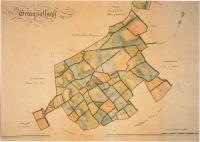
    Fig.6 Graigsallagh, from a volume of maps of the 'Manor of Maynooth'(1821) by Sherrard, Brassington and Green.(Courtesy of carton Desmesne)

    Fig.6 Graigsallagh, from a volume of maps of the ‘Manor of Maynooth'(1821) by Sherrard, Brassington and Green. (Courtesy of carton Desmesne)

    all elements of ostentatious showing-off of house and demesne in the highly status-sensitive society of the eighteenth century. The map shows the house and yards much as they are today. The walled garden is depicted with its interior detail. The lake had not yet been made—it had to await the damming of the Rye Water stream in the 1760s. Maynooth town (Fig.5) is shown at one of the major turning points in its history. What Rocque recorded was the almost medieval huddle of houses around the castle, with the main Galway road still in evidence passing through the toll gatehouse at the castle. However, at the east of the town, symbolically joining the avenue which led to Carton, is evidence of the beginning of the new town plan of Maynooth, with the newly laid-out main street as we have inherited it today. In what are now the grounds of Maynooth College, there are some curious ornamental (vegetable?) gardens reminiscent of earlier classical designs. Rocque’s legacy to Irish surveying and cartography is affirmed in a succession of later maps of Carton, which was possibly his first and certainly his most important private surveying undertaking. In 1769 his distinguished successor, Bernard Scalé, produced a superb map of the demesne at ten perches to the inch. In 1821, a volume of maps of the ‘Mannor of Maynooth’ (including Carton Park) was produced by Sherrard, Brassington and Greene (Fig.6). This was a leading firm of surveyors in early nineteenth-century Ireland and Thomas Sherrard had been a pupil of Scalé. Conclusion Although the eighteenth century is regarded as poorly supplied with primary sources, the growing accessibility of private estate papers is helping to expand the coverage and knowledge of this period. Estate surveys are an especially important components in these private collections. The changing landscape which they record is one of the most notable characteristics of the eighteenth-century ‘age of improvement’, because all the radical social and economic transformations of the age were inscribed indelibly on the Irish landcape of town and country. The later comprehensive maps of the Ordnance Survey recorded the landscape at the end of this cycle of change, though fortunately before the traumatic changes which accompanied the Famine. Although questions on the representativeness of extant estate maps are valid, those that have survived may provide valuable information on the extent and nature of enclosures, on changes in settlement patterns, on the evolution of placenames, on the development of road networks. Many of the surveys show house locations and although it is possible that many cabins were omitted or mapped inconsistently more systematic analysis of estate maps might throw light on the process of demographic expansion in the century before the Famine.   Origins : Co Clare Dimensions :65cm x 55cm
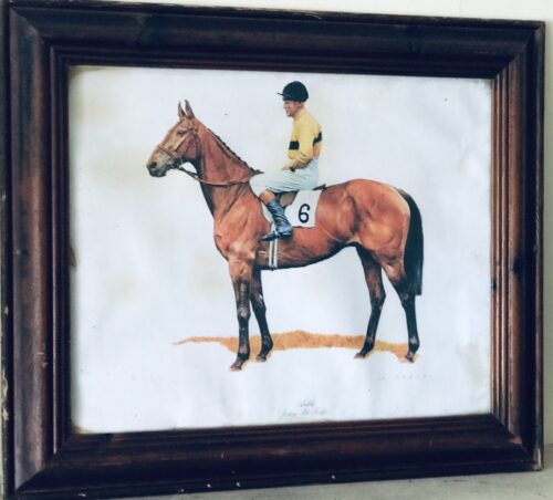
  • Beautiful portrait style print, in antique hardwood frame, depicting the great Arkle with regular jockey Pat Taafe on board wearing the distinctive yellow and black silks of Arkle's owner Anne,Duchess of Westminster. Arkle (19 April 1957 – 31 May 1970) was an Irish Thoroughbred racehorse. A bay gelding by Archive out of Bright Cherry, he was the grandson of the unbeaten (in 14 races) flat racehorse and prepotent sire Nearco. Arkle was born at Ballymacoll Stud, County Meath, by Mrs Mary Alison Baker of Malahow House, near Naul, County Dublin. He was named after the mountain Arkle in Sutherland, Scotland that bordered the Duchess of Westminster’s Sutherland estate. Owned by Anne Grosvenor, Duchess of Westminster, he was trained by Tom Dreaper at Greenogue, Kilsallaghan in County Meath, Ireland, and ridden during his steeplechasing career by Pat Taaffe. At 212, his Timeform rating is the highest ever awarded to a steeplechaser. Only Flyingbolt, also trained by Dreaper, had a rating anywhere near his at 210. Next on their ratings are Sprinter Sacre on 192 and then Kauto Star and Mill House on 191. Despite his career being cut short by injury, Arkle won three Cheltenham Gold Cups, the Blue Riband of steeplechasing, and a host of other top prizes. On 19th April, 2014 a magnificent  1.1 scale bronze statue was unveiled in Ashbourne, County Meath in commemoration of Arkle.In the 1964 Cheltenham Gold Cup, Arkle beat  Mill House (who had won the race the previous year) by five lengths to claim his first Gold Cup at odds of 7/4. It was the last time he did not start as the favourite for a race. Only two other horses entered the Gold Cup that year. The racing authorities in Ireland took the unprecedented step in the Irish Grand National of devising two weight systems — one to be used when Arkle was running and one when he was not. Arkle won the 1964 race by only one length, but he carried two and half stones more than his rivals. The following year's Gold Cup saw Arkle beat Mill House by twenty lengths at odds of 3/10. In the 1966 renewal, he was the shortest-priced favourite in history to win the Gold Cup, starting at odds of 1/10. He won the race by thirty lengths despite a mistake early in the race where he ploughed through a fence. However, it did not stop his momentum, nor did he ever look like falling. Arkle had a strange quirk in that he crossed his forelegs when jumping a fence. He went through the season 1965/66 unbeaten in five races. Arkle won 27 of his 35 starts and won at distances from 1m 6f up to 3m 5f. Legendary Racing commentator Peter O'Sullevan has called Arkle a freak of nature — something unlikely to be seen again. Besides winning three consecutive Cheltenham Gold Cups (1964, 1965, 1966) and the 1965 King George VI Chase, Arkle triumphed in a number of other important handicap chases, including the 1964 Irish Grand National (under 12-0), the 1964 and 1965 Hennessy Gold Cups (both times under 12-7), the 1965 Gallagher Gold Cup (conceding 16 lb to Mill House while breaking the course record by 17 seconds), and the 1965 Whitbread Gold Cup(under 12-7). In the 1966 Hennessy, he failed by only half a length to give Stalbridge Colonist 35 lb. The scale of the task Arkle faced is shown by the winner coming second and third in the two following Cheltenham Gold Cups, while in third place was the future 1969 Gold Cup winner, What A Myth. In December 1966, Arkle raced in the King George VI Chase at Kempton Park but struck the guard rail with a hoof when jumping the open ditch, which resulted in a fractured pedal bone; despite this injury, he completed the race and finished second. He was in plaster for four months and, though he made a good enough recovery to go back into training, he never ran again. He was retired and ridden as a hack by his owner and then succumbed to what has been variously described as advanced arthritis or possibly brucellosis and was put down at the early age of 13. Arkle became a national legend in Ireland. His strength was jokingly claimed to come from drinking 2 pints of Guinness  a day. At one point, the slogan Arkle for President was written on a wall in Dublin. The horse was often referred to simply as "Himself", and he supposedly received items of fan mail addressed to 'Himself, Ireland'. The Irish government-owned Irish National Stud, at Tully, Kildare, Co. Kildare, Ireland, has the skeleton of Arkle on display in its museum. A statue in his memory was erected in Ashbourne Co. Meath in April 2014. Origins :Co Limerick Dimensions :50cm x 60cm
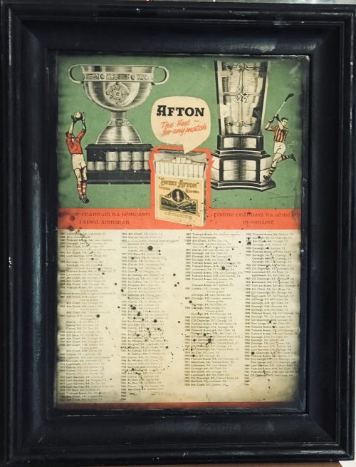
  • Fantastic original Sweet Afton Virginia Cigarettes Advertising print with beautiful images of the two holy grails in Irish Sport-The Sam Maguire Cup for the All Ireland Gaelic football Champions and the Liam McCarthy Cup for the All Ireland Hurling Champions.A footballer from Cork and a hurler from Kilkenny are featured in this charming print. Also the winners and shorelines from All Irelands from 1887 to 1963 are included underneath.Acharming addition to any wall space Dimensions: 75cm x 55cm   Origins;Aughrim Co Galway  Unglazed  
     
    Sweetafton.jpg
    A 20-pack of Sweet Afton cigarettes with a text warning in both Irish and English stating "Smoking kills".
    Product type Cigarette
    Old Afton advertisement on a pub in Wexford
    Sweet Afton was an Irish brand of short, unfiltered cigarettes made with Virginia tobacco and produced by P.J. Carroll & Co., Dundalk, Ireland, now a subsidiary of British American Tobacco. The Sweet Afton brand was launched by Carroll's in 1919 to celebrate the link between Dundalk and the national poet of Scotland, Robert Burns. Burns' eldest sister, Agnes, lived in Dundalk from 1817 until her death in 1834 and was buried in the cemetery of St. Nicholas's Church in the town. Carroll's thought that the brand would only be successful in Scotland if the carton simply had an image of Burns, or Scottish name on the packet, so the people of Dundalk were canvassed and the name Sweet Afton was chosen. The name is taken from Burns' poem "Sweet Afton", which itself takes its title from the poem's first stanza: Flow gently, sweet Afton, amang thy green braes Flow gently, I’ll sing thee a song in thy praise My Mary’s asleep by they murmuring stream Flow gently, sweet Afton, disturb not her dream. A larger version of the cigarette was also marketed under the brand name Afton Major. This name served as inspiration for Carroll's later Majorbrand of tipped cigarettes. As of Autumn 2011, British American Tobacco no longer manufactures Sweet Afton cigarettes. The text "Thank you for your loyalty, unfortunately Sweet Afton will not be available in the future. However Major, our other Irish brand with similar tobacco will still be widely available for purchase." was written on a sticker that was put on the last line of packs, before it went out of production. The brand proved particularly popular with post World War II Rive Gauche Paris. It was reputed to be Jean-Paul Sartre's preferred cigarette, and also featured prominently in Louis Malle's film Le Feu Follet, as well as a number of other Nouvelle Vague films.Margot Tenenbaum (played by Gwyneth Paltrow) from Wes Anderson's 2001 film The Royal Tenenbaums also smokes Sweet Aftons. Thomas Shelby, in Peaky Blinders, smokes Sweet Aftons. They are also the favoured brand of Gerhard Selb, the eponymous private investigator in the trilogy by Bernhard Schlink
    Origins : Co Kilkenny Dimensions : 48cm x 62cm
Go to Top