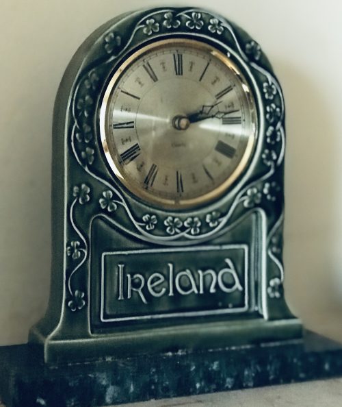
• Nice print of the very well known and celebrated Ross Castle,Killarney,Co Kerry. Killarney Co Kerry  22cm x 29cm Ross Castle ( is a 15th-century tower house and keep on the edge of Lough Leane, in Killarney National Park, County Kerry, Ireland. It is the ancestral home of the Chiefs of the Clan O'Donoghue, later associated with the Brownes of Killarney. The castle is operated by the Office of Public Works, and is open to the public seasonally with guided tours.

    History

    Ross Castle was built in the late 15th century by local ruling clan the O'Donoghues Mór (Ross), though ownership changed hands during the Second Desmond Rebellion of the 1580s to the MacCarthy Mór. He then leased the castle and the lands to Sir Valentine Browne, ancestor of the Earls of Kenmare. The castle was amongst the last to surrender to Oliver Cromwell's Roundheads during the Irish Confederate Wars, and was only taken when artillery was brought by boat via the River Laune. Lord Muskerry (MacCarthy) held the castle against Edmund Ludlow who marched to Ross with 4,000 foot soldiers and 200 horse; however, it was by water that he attacked the stronghold. The Irish had a prophecy that Ross could never be taken until a warship could swim on the lake, an unbelievable prospect.
    Ross may all assault disdain
    Till on Lough Lein strange ship shall sail.
    The ships were built in Kinsale, brought by water to Killorglin and then dragged by oxen to Ross Castle. The sight of the ships unnerved the onlookers and the castle soon submitted.
    Ross Castle in the last decade of the 19th century
    At the end of the wars, the Brownes were able to show that their heir was too young to have taken part in the rebellion and they retained the lands. By about 1688, they had erected a mansion house near the castle, but their adherence to King James II of England after the Glorious Revolution caused them to be exiled. The castle became a military barracks, which remained so until early in the 19th century. The Brownes did not return to live at Ross but built Kenmare House near Killarney. There is a legend that O'Donoghue leaped or was sucked out of the window of the grand chamber at the top of the castle and disappeared into the waters of the lake along with his horse, his table and his library. It is said that O'Donoghue now lives in a great palace at the bottom of the lake where he keeps a close eye on everything that he sees.

    Governors

    Governors of the garrison at Ross Castle included:

    Defensive features

    Illustration of Ross Castle inner structure

    Basic structure

    The castle is typical of strongholds of Irish chieftains built during the Middle Ages. The tower house had square bartizans on diagonally opposite corners and a thick end wall. The tower was originally surrounded by a square bawn defended by round corner towers on each end. The structure is stacked and mortared stone with thick walls and providing five inner stories plus the roof.

    Front entrance

    The front entrance was a small anteroom secured by an iron grill or 'yett' at the outer wall. The yett could be closed from inside via a chain that could then be secured even if the front door was closed. This room provided small side access holes and a "murder-hole" above which allowed the defenders to attack anybody in the room. The front door, on the inside of the anteroom, was constructed of two layers of thick Irish oak, one layer 90 degrees to the other with the boards riveted together. If the door was a single layer with the wood fibres going in a single direction, it would have been possible to split the door. The second cross layer prevented that. The door opened inward and was backed by two heavy beams fitted into the stone structure.

    Windows

    Windows at the lower levels were vertical thin slits preventing entrance into the structure but allowing persons inside to aim and fire arrows or guns at attackers. The windows on the top levels were larger to allow in light. It was felt that attackers would not be able to scale to those heights so larger windows were safe.

    Machicolation

    Machicolations were stone structures at the top of the castle protruding out from the wall with a hole in the floor. There are two on Ross Castle, one over the front door and another on the back wall. The one at the front would allow defenders to drop stones or boiling oil on attackers at the front door, the only entrance to the castle.
    Ross Castle from the lake

    Parapet

    The parapet at roof level is 'crenellated' providing ups, 'merlons' and downs, 'crenels', to allow defenders to hide behind the merlons while firing arrows or guns through the crenels.

    Inner rooms

    The first floor was used for storage. The second floor was a living space for the house attendants and guards. Straw was spread on the floor to sleep on. There was typically no furniture. The third floor was for food preparation and living and eating space for the house attendants and guards. The fourth floor was the sleeping and living space for the chieftain and his family. The fourth floor had an arched stone roof supporting a stone floor of the fifth story as compared to the wood beam floors of the lower stories. The fifth floor was the great room where the chieftain ate and entertained. This room was also the last sanctuary as it had a stone floor as a fire break from fire in the lower floors.

    Gallery

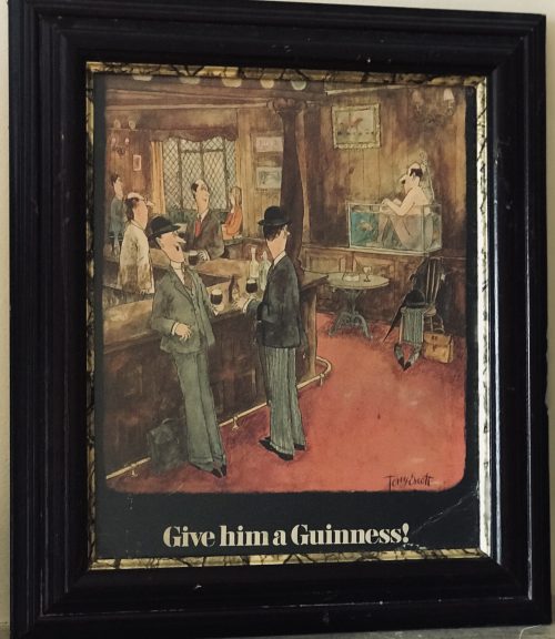
  • Humorous,Guinness showcard designed by the artist Tony Escott  from the 1960s.Escott was an English cartoonist & illustrator synonymous with Guinness adverts in the 1960s.Advertising showcards such as this excellent example were supplied by Guinness to be displayed on prominent locations in pubs such as counter tops and window sills etc Guinness advertising has become an institution, virtually since Arthur Guinness set up the brewery in 1779.Today Guinness advertising is not just a subject for fond remembrance of past campaigns - nowadays its a subject for the specialist collector.Every item, from original artwork to old Guinness labels -has a price and a buyer. All Guinness advertising has done is create a focal point for peoples interest in and affection for,Guinness itself- that curious looking drink with a curious sounding name. Indeed its tempting to talk about Guinness advertising as if it were a generic term,describing a particular type or style of advertising.This is not the case-in its form, content and approach ,Guinness advertising has been as varied as the communications media it has enployed. When the brewery giant first began advertising in 1928,there had been very little study done in the field of market research and the critical analysis of what became to be called the "persuasion industry' had yet to take place.In launching its first campaign, however,Guinness decreed that its advertisements 'should at all times be done extremely well and in good taste -S.H Benson Ltd.,the venerable advertising agency charged with carrying out that edict,began with a refreshing directness- an appetising pint of what is affectionately called the 'black stuff' and the simple slogan:'GUINNESS is good for you.' Guinness has since  always been among the leaders in the development of the craft of advertising and from the outset, they have been particularly conscious of their public responsibilities as an advertiser.Its fair to say no other alcoholic beverage has acquired the universal goodwill possessed by Guinness.Stanley Penn,one of Bensons copyrighters once remarked ' Guinness always enjoyed their advertising.They liked their advertising to be liked'.and so Bensons gave the already household  Guinness name character and personality ,they made its friend more than a mere acquaintance. After a few years ,some money and a lot of imagination later,Bensons began mixing their Guinness with a  dash or two of levity and humour.It was the beginning of many years of fun and frolics-starting with John Gilroys' charming menagerie of Guinness guzzling animals and the most outrageous puns and parodies- right up to the present day. Origins : Dublin Dimensions :40cm x 34cm
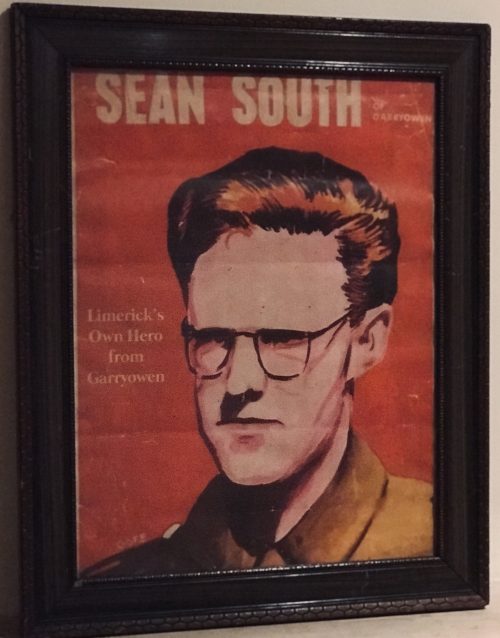
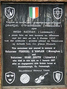
  • Nearly a Che Guevera style to this poster of the rebel hero Sean South from Garryowen in the heart of Limerick City. Origins : Limerick.      Dimensions :  54cm x 42cm      Glazed Sean Southc. 1928 – 1 January 1957)was a member of an IRA military column led by Sean Garland on a raid against a Royal Ulster Constabulary barracks in Brookeborough, County Fermanagh, Northern Ireland, on New Year's Day 1957.South, along with Fergal O'Hanlon, died of wounds sustained during the raid.

    Early life

    Seán South was born in Limerick where he was educated at Sexton Street Christian Brothers School, later working as a clerk in a local wood-importing company called McMahon's. He was a member of a number of organisations, including Clann na Poblachta, Sinn Féin, the Gaelic League and the Legion of Mary. In Limerick he founded the local branch of Maria Duce, a social Roman Catholic organisation, where he also edited both An Gath and An Giolla. He had received military training as a lieutenant of the Irish army reserve, the Local Defence Force (LDF), which would later become An Fórsa Cosanta Áitiúil (the FCA), before he became a volunteer in the Irish Republican Army. Being a member of An Réalt (the Irish-speaking chapter of the Legion of Mary),South was a devout Catholic and a conservative, even by the standards of the day.It was at a meeting of An Réalt that he met his only serious girlfriend, Máire de Paor. She was a schoolteacher from Limerick, and was a great lover of the Irish language. He was also a member of the Knights of Columbanus. In 1949, South wrote a series of letters to his local newspaper, the Limerick Leader. These letters condemned Hollywood films for what South regarded as their immoral messages. South accused these films of promoting a "stream of insidious propaganda which proceeds from Judeo-Masonic controlled sources, and which warps and corrupts the minds of our youth."South also claimed that the American film industry was controlled by "Jewish and Masonic executives dictating to Communist rank and file." In his letters, South also denounced Irish trade unions, and praised the activities of Senator Joseph McCarthy in the United States.

    Death

    On New Year's Day 1957, 14 IRA volunteers crossed the border into County Fermanaghto launch an attack on a joint RUC/B Specials barracks in Brookeborough. During the attack a number of volunteers were injured, two fatally. South and Fergal O'Hanlon died of their wounds as they were making their escape. Their bodies were brought into an old sandstone barn by their comrades. The stone from the barn was used to build a memorial at the site. A young Catholic constable, John Scalley, was killed in the ensuing gun battle between the IRA unit and the RUC.

    Commemoration

    The attack on the barracks inspired two popular rebel songs: ‘Seán South of Garryowen' and ‘The Patriot Game '.
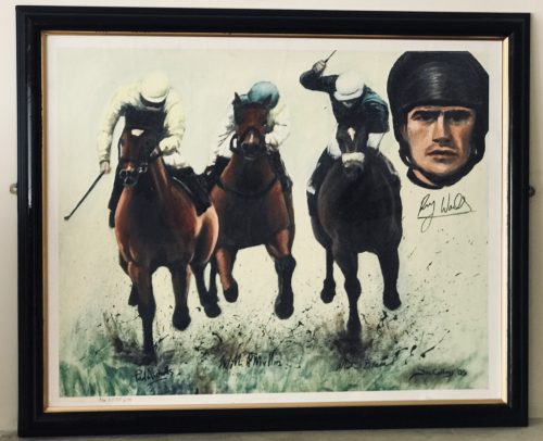
  • Superb limit edition artwork venerating the great Ruby Walsh,one of the greatest jump jockeys in history, signed by Ruby himself and champion trainers Paul Nicholls & Willie Mullins. Origins :Lismore  Co Waterford     Dimensions : 70cm x 85cm Rupert "Ruby" Walsh (born 14 May 1979 in Kill, County Kildare, Ireland) is an Irish former jockey. He is the second child, and eldest son, of former champion amateur jockey Ted Walsh and his wife Helen. Walsh is the third most prolific winner in British and Irish jump racing history behind only Sir Anthony McCoy and Richard Johnson.

    Career

    Showing talent from an early age, Walsh won the Irish amateur title twice, in 1996/97 (aged 18) and 1997/98, before turning professional. He won the English Grand National in 2000 at his first attempt, aged 20, on Papillon,a horse trained by his father and owned by Mrs J Maxwell Moran.Father and son then went on to win the Irish Grand National with Commanche Court the same year. In the 2004/05 season Walsh won three of the four Nationals: the Irish on the 2006 Grand National winner, Numbersixvalverde, the Welsh on subsequent 2007 Grand National winner Silver Birch, and the English on Hedgehunter. He rode Cornish Rebel in the Scottish, but was beaten a short head by Joe's Edge. However, he had earlier success in that race on Take Control in 2002 and following the retirement in 2015 of Tony McCoy, became the only jockey currently riding to have won all four Nationals. Walsh has one of the best Grand National records amongst current jockeys having won the race twice (2000, 2005), finished second once (2006), third once (2009) and fourth twice (2001, 2002). Walsh rode over 2500 winners including 59 winners at the Cheltenham Festival since his first win in 1998 on Alexander Banquet. These include the 2004 Queen Mother Champion Chase on Azertyuiop, the 2007 and 2009 Cheltenham Gold Cup on the favourite, Kauto Star and two subsequent Queen Mother successes in 2008 and 2009 on the brilliant Master Minded. He also won both the 2006 Tingle Creek Chase and the King George VI Chase on Kauto Star. He repeated the King George feat, again on Kauto Star, in 2007 (just days after returning from injury), 2008 and 2009 when Kauto Star won impressively by 36 lengths. He reclaimed the King George VI Chase in 2011 on board Kauto Star after Long Run won the race in 2010. He won the Hennessy Gold Cup twice, in 2003 on Strong Flow, and in more recent times, 2009 with Denman. He also won the Whitbread Gold Cup twice, in 2001 and 2003 (the latter when it was run as the Attheraces Gold Cup), both times on Ad Hoc. In 2007, Walsh won the inaugural British Horseracing Board Jockeys' Order of Merit award. Walsh was been Irish jump jockey champion twelve times – 1998/99, 2000/01, 2004/05, 2005/06, 2006/07, 2007/08, 2008/09, 2009/10, 2013/14, 2014/15, 2015/16 and 2016/17. Walsh's recent dominance of the jockeys' championship in Ireland is all the more remarkable given that for more than ten years he had a unique riding arrangement with two powerful stables, one on either side of the Irish Sea. Based in Calverstown, County Kildare, where he lives with his wife Gillian, he rode predominantly for Willie Mullins in Ireland. Formerly he also spent a substantial proportion of his time riding in England for Somerset-based champion trainer Paul Nicholls, the former trainer of Kauto Star. In January 2007, Walsh achieved the fastest ever century of winners in Irish jumps racing history aboard Bluestone Lad at Gowran Park. He ended the 2006/07 season with a combined total in Ireland and the UK of 198 winners, higher than any other jockey from either country that year. (This total was later increased to 200 on the disqualification of two horses for positive tests to banned substances. In both instances, Walsh had ridden the subsequently-promoted runners-up.) He repeated this feat in 2007/08, riding his 200th winner on Andreas at Sandown on his penultimate ride of the season. He rode his 1,000th Irish winner, Rare Article, at Sligo in May 2008. At the 2009 Cheltenham Festival Walsh rode a record-breaking seven winners over the four days. He equalled that record at the 2016 Cheltenham Festival. On the second day of the 2010 festival he rode Sanctuaire to victory in the Fred Winter Juvenile Novices Handicap Hurdle and therefore became the jockey with the most wins in the history of the Cheltenham festival. In March 2011, Walsh rode Hurricane Fly to victory in the Champion Hurdle at Cheltenham, finishing ahead of Peddlers Cross and Oscar Whisky. It was Walsh's first victory in the feature race of the opening day at the Cheltenham Festival. He won his 2,500 race on Au Quart De Tour at Gowran park on 20 January 2016. As of 2019, Walsh is the Festival's most successful rider with 59 wins and has won the leading rider's award eleven times within the last fourteen years. In August 2015 Walsh won the Australian Grand National on Bashboy. On 1 May 2019, Walsh announced his retirement from racing with immediate effect after a career spanning 24 years. The announcement was made after he rode Kemboy to victory in the Punchestown Gold Cup. It was the 213th Grade One win for Walsh
  • The ideal present for that someone in your lifewho is impossible to buy for ! Or you just want to impress .The lucky recipient of an irishpubemporium gift voucher can trawl through hundreds & hundreds of our authentic ex Irish pub antiques/pieces of memorabilia to find something that catches their eye,giving them an enjoyable buying experience and saving you a lot of angst! Just fill in your details as if purchasing details as normal and we will email the lucky recipient the voucher which can be redeemed at any date,used as a deposit or credit towards a larger value item.No expiry date on our vouchers and remember irishpubemporium antiques are only rising in value as time goes by!  
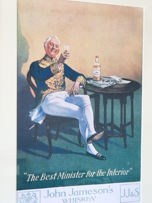
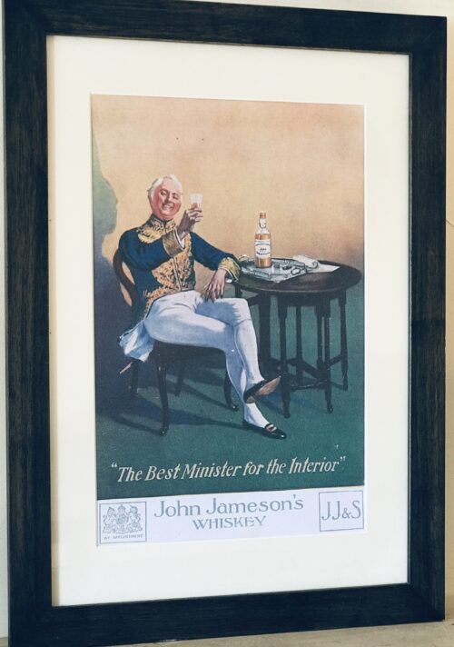
  •   55cm x 40cm  Athenry Co Galway John Jameson was originally a lawyer from Alloa in Scotland before he founded his eponymous distillery in Dublin in 1780.Prevoius to this he had made the wise move of marrying Margaret Haig (1753–1815) in 1768,one of the simple reasons being Margaret was the eldest daughter of John Haig, the famous whisky distiller in Scotland. John and Margaret had eight sons and eight daughters, a family of 16 children. Portraits of the couple by Sir Henry Raeburn are on display in the National Gallery of Ireland. John Jameson joined the Convivial Lodge No. 202, of the Dublin Freemasons on the 24th June 1774 and in 1780, Irish whiskey distillation began at Bow Street. In 1805, he was joined by his son John Jameson II who took over the family business that year and for the next 41 years, John Jameson II built up the business before handing over to his son John Jameson the 3rd in 1851. In 1901, the Company was formally incorporated as John Jameson and Son Ltd. Four of John Jameson’s sons followed his footsteps in distilling in Ireland, John Jameson II (1773 – 1851) at Bow Street, William and James Jameson at Marrowbone Lane in Dublin (where they partnered their Stein relations, calling their business Jameson and Stein, before settling on William Jameson & Co.). The fourth of Jameson's sons, Andrew, who had a small distillery at Enniscorthy, Co. Wexford, was the grandfather of Guglielmo Marconi, inventor of wireless telegraphy. Marconi’s mother was Annie Jameson, Andrew’s daughter. John Jameson’s eldest son, Robert took over his father’s legal business in Alloa. The Jamesons became the most important distilling family in Ireland, despite rivalry between the Bow Street and Marrowbone Lane distilleries. By the turn of the 19th century, it was the second largest producer in Ireland and one of the largest in the world, producing 1,000,000 gallons annually. Dublin at the time was the centre of world whiskey production. It was the second most popular spirit in the world after rum and internationally Jameson had by 1805 become the world's number one whiskey. Today, Jameson is the world's third largest single-distillery whiskey. Historical events, for a time, set the company back. The temperance movement in Ireland had an enormous impact domestically but the two key events that affected Jameson were the Irish War of Independence and subsequent trade war with the British which denied Jameson the export markets of the Commonwealth, and shortly thereafter, the introduction of prohibition in the United States. While Scottish brands could easily slip across the Canada–US border, Jameson was excluded from its biggest market for many years.
    Historical pot still at the Jameson distillery in Cork
    The introduction of column stills by the Scottish blenders in the mid-19th-century enabled increased production that the Irish, still making labour-intensive single pot still whiskey, could not compete with. There was a legal enquiry somewhere in 1908 to deal with the trade definition of whiskey. The Scottish producers won within some jurisdictions, and blends became recognised in the law of that jurisdiction as whiskey. The Irish in general, and Jameson in particular, continued with the traditional pot still production process for many years.In 1966 John Jameson merged with Cork Distillers and John Powers to form the Irish Distillers Group. In 1976, the Dublin whiskey distilleries of Jameson in Bow Street and in John's Lane were closed following the opening of a New Midleton Distillery by Irish Distillers outside Cork. The Midleton Distillery now produces much of the Irish whiskey sold in Ireland under the Jameson, Midleton, Powers, Redbreast, Spot and Paddy labels. The new facility adjoins the Old Midleton Distillery, the original home of the Paddy label, which is now home to the Jameson Experience Visitor Centre and the Irish Whiskey Academy. The Jameson brand was acquired by the French drinks conglomerate Pernod Ricard in 1988, when it bought Irish Distillers. The old Jameson Distillery in Bow Street near Smithfield in Dublin now serves as a museum which offers tours and tastings. The distillery, which is historical in nature and no longer produces whiskey on site, went through a $12.6 million renovation that was concluded in March 2016, and is now a focal part of Ireland's strategy to raise the number of whiskey tourists, which stood at 600,000 in 2017.Bow Street also now has a fully functioning Maturation Warehouse within its walls since the 2016 renovation. It is here that Jameson 18 Bow Street is finished before being bottled at Cask Strength. In 2008, The Local, an Irish pub in Minneapolis, sold 671 cases of Jameson (22 bottles a day),making it the largest server of Jameson's in the world – a title it maintained for four consecutive years.  
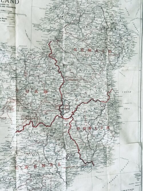
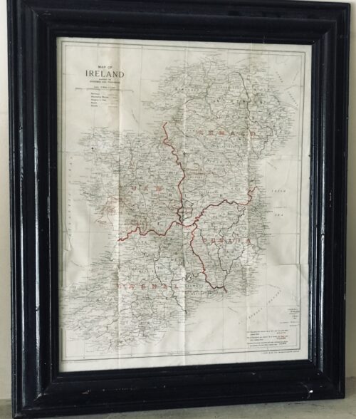
  • Superb 1940s era vintage original map showing the dioceses(!) and provinces of Ireland published by J.Duffy & Co.Ltd Westmoreland St Dublin. James Duffy (1809 – 4 July 1871) was a prominent Irish author and publisher. Duffy's business would become one of the major publishers of Irish nationalist books, bibles, magazines, Missals and religious texts throughout the 19th and 20th centuries. He was also a major publisher of Irish fiction.[1] He was described as having "invented a new kind of cosy family Catholicism. Duffy was born in Monaghan. He was educated at a hedge school and began his business as a bookseller through purchasing Protestant bibles given to Catholics. He then traveled to Liverpoolwhere he traded them for more valuable books. In 1830 he founded his own company, James Duffy and Sons and issued Boney's Oraculum, or Napoleon's Book of Fate, which experienced huge sales. Boney's Oraculum would later be the object of an allusion in a speech of Capt. Boyle in Seán O'Casey's 1924 play Juno and the Paycock. Another great editorial success was achieved when he collaborated with Charles Gavan Duffy (no relation) from 1843 to 1846 to publish poetry from the writers of The Nation. By the 1860s he was employing 120 staff members at his various enterprises in Dublin.[4] In 1860 he started Duffy's Hibernian Magazine, edited by Martin Haverty. It was a monthly, price eight pence, and ran for two years. The contributors included Charles Patrick Meehan, Julia Kavanagh, Denis Florence MacCarthy, John O'Donovan, William Carleton, Thomas D'Arcy McGee, and William John Fitzpatrick, and the articles were all signed. A second series began in 1862, renamed Duffy's Hibernian Sixpence Magazine, with Meehan as editor, which extended to six volumes and ended in June 1865. These and other relatively cheap magazines took advantage of the new-found confidence in home-grown literature and also offered an outlet for Irish authors. Among the magazines he published were:
    • Duffy's Irish Catholic Magazine (1847)
    • Catholic Guardian
    • Christian Family Library
    • Duffy's Hibernian Magazine
    • Illustrated Dublin Journal
    • Duffy's Fireside Magazine: A Monthly Miscellany (November 1850 – October 1852) (price: 4d)
    • Duffy's Hibernian Sixpence Magazine (ceased publication in 1864)
    Duffy's magazines are seen as a forerunner of Ireland's Own today. Among books he published were:
    • The Spirit of the Nation. Ballads and Songs by the Writers of The Nation, with Original and Ancient Music (1845)
    • The Poetry of Ireland. Further collections from the writers of The Nation (1845-1846)
    • The Ballad Poetry of Ireland
    • The Book of Irish Ballads
    • an 1861 edition of the Douay Bible, a copy of which is owned by the Central Catholic Library in Dublin
    • John O'Hart, Irish landed gentry: when Cromwell came to Ireland (Dublin: James Duffy & Sons, 1887)
    • John O’Hanlon, Lives of the Irish Saints, Vol 6 (James Duffy and Sons, 1891)
    • Gerald Griffin The Invasion (Dublin, James Duffy & Sons)
    The publishing house was based at 7 Wellington Quay, Dublin, and later at 14 & 15 Wellington Quay. James Duffy and Co. Ltd. of 38 Westmoreland Street was still in business in the late 20th century.   HISTORY OF MAPPING IN IRELAND: Before the Ordnance Survey undertook the mapping of the country from Malin to Mizzen in the 1830s, cartography, surveying and landscape map production in Ireland were essentially a private undertakings. There had been a seventeenth-century precedent for state involvement in mapping in the various plantation surveys, but after Sir William Petty’s Down Survey (Fig.1) and the more or less final allocation of landed estates in the 1690s, there was no more  central goverment involvement. Throughout the eighteenth century, competition in an expanding market for estate surveys produced a flowering of cartographic enterprise which has added considerably to our understanding of pre-famine social and economic development. This explosion in estate maps, characterised by John Andrews as the ‘golden age of the Irish land surveyor’, was very much a reflection of agriculture-related economic expansion, the development of rural industry and the growth of settlement and landscape embellishment, which has for long been characterised in Europe as the ‘age of improvement’. Though interpretations of the period differ in focus, the landed estate became the principal agency through which economic and social change was mediated throughout the Irish landscape. As with most generalisations, this interpretation may mislead—estates varied enormously in size; many owners were non-resident either on their properties or in Ireland; and there were great contrasts in management order on different estates—but it is a useful model nonetheless.
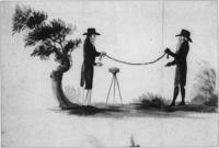
    Fig.2 The chain and circumferentor were still the main tools of the trade in the 1750s.(Courtesy of the National Library of Ireland)

    Fig.2 The chain and circumferentor were still the main tools of the trade in the 1750s. (Courtesy of the National Library of Ireland)

    Rival surveyors Ornamentation and embellishment of estates, especially from the middle of the eighteenth century, employed an expanding army of architects, landscape gardeners, painters, stuccadores, agriculturists, as well as lawyers and agents. Included with these personnel were surveyors and cartographers commissioned by landowners to produce maps both functional and ornamental for the estate office or the drawing room. Indeed later in the century, in the demographic scramble for land, surveyors were frequently also engaged by both owners and tenants to ‘squeeze’ a few more acres out of estate or farm. So active was the market that surveyors vied with each other in producing the most accurate maps. Many of their disputes were personal and public. In the middle of the century, Joshua Wight was called a dunce by a rival. As early as 1716, William Starrat knew that his calculation of forty acres for Inishmakill townland in Fermanagh would ‘be disputed, because Mr Moore’s survey made it only eighteen acres; and besides it is the opinion of a great many that knows the island that it contains about twenty acres. As for Mr Moore’s account, there is no ground for depending on it, because he only viewed it from the mainland and no man can measure an irregular plain at a distance.’ The number of surveys increased as the eighteenth century progressed reflecting expanding estate income and rural economic activity. As with architects and landscape designers, there was a community of surveyors distinguished from each other by their talents, reflected in turn by their fees. Their work ranged from modest, even mediocre and poor surveys, which were poorly realised and often inaccurate, to superlative and innovative productions of great beauty and accuracy. Presumably smaller, less well-off proprietors could only afford the more mediocre efforts. ‘Country surveyors’ worked at local level producing surveys for tenant farmers, assisting with bog divisions, laying out the lines for new roads. The best cartographers like John Rocque and Bernard Scalé were engaged by great landowners like the Duke of Leinster or the Marquis of Downshire. Chain and circumferentor Surveying throughout the eighteenth century occurred against a background of practice inherited from the seventeenth where land had been let by townland. Townland boundary delineation and calculation of townland acreage thus became the main preoccupations of surveyors. The internal geography of townlands was of limited interest to landowners and thus to surveyors, much to the frustration of later historians. Surveyors were seldom innovative; Petty’s style of mapping overshadowed eighteenth-century surveys. Indeed he remained dominant in most theoretical and practical aspects of surveying and little changed in its understanding for a century after him—the chain and circumferentor were still the main tools of the trade in the 1750s (Fig.2). The chain was used for horizontal measurements. The circumferentor was a somewhat obsolete instrument used for plotting angles. Apart from a frequent lack of standardisation in instruments, there was also a regional variation in units of measurement: Irish, plantation and English acres (and perches) were in use, though by the end of the century surveyors increasingly provided measurements in both Irish and statute acres. One of the earliest innovators was Thomas Raven, who had worked with the Ulster plantation producing some fine maps to accompany surveys of the new settlements. Later on he produced estate maps for a number of landowners in Munster and Connacht. The Earl of Essex engaged him to produce a survey of his lands in Farney in south Monaghan which provide a unique glimpse of this Gaelic and slightly planted landscape in 1634 (Fig.3). His maps, in atlas format, show tates (modern townlands) together with more than 400 hundred cabins and houses, wells, mills, churches, as well as indications of land quality within the townland units. Unforunately this amount of detailing of local landscapes did not continue as standard practice with Irish surveyors in the eighteenth century . Boundaries Surveys were undertaken for many reasons—to accompany the sale of property, the settlement of disputes, succession to the estate, leasing of holdings or the introduction of new management. The principal objective of the surveys was to determine the extent of the property in terms of boundaries or areal extent, with a sometimes secondary purpose of measuring land quality. In the later seventeenth and early eighteenth centuries, disputes about land boundaries frequently occurred between landowners—a throwback to the hastily completed surveys of the plantation periods. Raven’s map of Farney, for instance, contains a number of boundaries on the northern limits of the estate marked ‘in controversie’. These disputes were generally settled by survey and agreement. Interestingly later in the eighteenth century and into the nineteenth, the focus of disagreement on boundaries moved from estate to farm level, with frequent disputes arising between tenants and their neighbours or landlords. The burning of land after cropping was an opportune time for measurement. Landowners were frequently called in to adjudicate between disputing tenants who often employed local surveyors to advance their case. Before the establishment of fixed hedges, there were many opportunities for disputes. Starrat’s surveys in the 1730s in the Fermanagh and Leitrim refer to the difficulites of selecting definitive bearings. In the rapid population expansion of the late eighteenth century, landlords often employed surveyors to lay out enclosures. For example, in the 1820s Shirley in Monaghan was engaged in laying out new field boundaries and in persuading his tenantry to plant quicksets. More often than not the lines of main hedges were laid down by the estate surveyor, with the tenant given freedom to subdivide their farms themselves. Frequently tenants employed local surveyors to help with this.
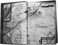
    Fig.3 Carrickmacross, from Thomas Raven's survey of Essex estate, County Monaghan 1634-5. Note the cluster of cabins, center right. (Courtesy of Marquis of Bath)

    Fig.3 Carrickmacross, from Thomas Raven’s survey of Essex estate, County Monaghan 1634-5. Note the cluster of cabins, center right. (Courtesy of Marquis of Bath)

    Rents and leases The falling in of leases in many parts of the country throughout the eighteenth century often revealed to the landowner extensive layers of subtenants who had fractured the land into smaller farms and enclosures. These were frequently taken on as tenants under the head landlord and their farms surveyed and mapped. Maps by Bernard Scalé of the Bath estate in Monaghan and the Devonshire estate in Waterford (Fig.4) were commissioned in the 1770s to assess the nature of change in settlement. In many cases, leases were granted at irregular intervals and landowners had to wait the falling-in of each lease. Great estate owners like Bath, Devonshire or Downshire would, however, undertake a complete survey of their estate and subsequently try to lease out most of their property in one letting. The more common practice, however, was to have individual farm surveys or portions of estates mapped. Also, agricultural development meant re-valuation of land: typically, drainage and wasteland reclamation in the later eighteenth century called for map and rent revisions. In these instances surveyers with their chains and painted pegs were unpopular with tenants who saw them as precursors of rent increases. In prefamine decades, their every move in the countryside was closely watched as the overcrowded acres, roods and perches, were meticulously measured out. John Rocque From the middle of the eighteenth century especially, estate improvements frequently involved extravagant investment in the landowner’s private gardens and demesnes. Elaborate maps of these were often produced to match the picturesque views frequently commissioned from fashionable painters. The maps of John Rocque probably represent the most artistic achievement of a cartographer in eighteenth-century Ireland. Rocque (c.1705-1762) was a member of the French Huguenot community in England who established a reputation as a superlative cartographer, with highly-regarded surveys of London, Paris and Rome to his credit. He was invited to Ireland by a number of Irish noblemen in 1754, mainly with the objective of undertaking a survey of Dublin. This he accomplished in 1756 and his map remains an unsurpassed record of Georgian Dublin (a fragment of which was reproduced on the old £10 note). Rocque was to revolutionise cartography and surveying in Ireland in the space of six years in the 1750s, so much so that in the 1820s, surveyors in Ireland were still being described as belonging to ‘the French school of Rocque’. The hallmark of his cartography was an unprecedented amount of fine detail on the cities and landscapes he mapped. His surveys were carried out by a small team of apprentices who helped to transmit Rocque’s ideas and techniques to the following generations of Irish surveyors. His most notable pupil and successor was Bernard Scalé, who established himself as a well known surveyor in the later eighteenth century (Fig.4). While Rocque was producing the printed surveys of Dublin and other Irish towns, he was also engaged by a number of Irish landlords to map their estates. His most important patron was the twentieth Earl of Kildare (later first Duke of Leinster) who lived at Carton outside Maynooth, and who owned 67,000 acres in a number of manors scattered throughout County Kildare. At the time of the survey (1757), Lord and Lady Kildare were in the process of radically transforming their house and environs in Maynooth. The architect Richard Castle (responsible for designing numerous great houses throughout Ireland) was involved in the remodelling of Carton. The Francini brothers were engaged to decorate the ceilings. So it is a tribute to Rocque’s exceptional reputation that he was involved with some of the most famous and fashionable artists and craftsmen in the transformation of Carton into one of the foremost palladian mansions in the country.
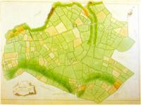
    Fig.4 The manor of Tallow 1774 - part of Bernard Scale's survey of County Waterford's Devonshire estates.(Courtesy of the Trustees of the Chatsworth Settlement)

    Fig.4 The manor of Tallow 1774 – part of Bernard Scale’s survey of County Waterford’s Devonshire estates. (Courtesy of the Trustees of the Chatsworth Settlement)

    Kildare estates The survey of the Kildare estates was produced in eight atlas volumes, each page containing individual maps of the townlands. This set of maps was subsequently dispersed and the maps of Maynooth Manor are currently held in the University Library, Cambridge. A recently-discovered wall map of Maynooth Manor now hangs in Maynooth College. Apart from minor details, it is essentially a replica, drawn on a large sheet, of the album format and may have been produced by Rocque as a working map for the estate office or as a decoration for the house at Carton. The Maynooth map is very characteristic of Rocque—showing the landscape almost as it might have looked from the air. It contains typical detail such as the cartouche with a view of Maynooth Castle. There is wide-ranging detail provided in each townland. Relief is shown by hachures in grey, water (including ditches) by a blue wash. Buildings are shown in block plan—a Rocque innovation—contrasting with earlier, more impressionistic pictorial conventions for buildings. In some of these, the farmyards containing hay or straw stacks are shown. Arable land is usually brown with stippling to represent ridges or furrows, though the full meaning of his code of symbols is still a mystery. Meadow and pasture are shown in light green. Tree symbols show orchards and woodlands; hedges are depicted by lines of bushes. In some areas, fences without hedging are shown by means of a grey herring-bone device. There are also springs, mills, quarries, forges, pigeon houses, prehistoric forts and field names. Each field is numbered in sequence within each townland, and details of the area, and sometimes the content of the field, are given in the reference panel.
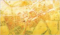
    Fig.5 The town of Maynooth, County Kildare, from John Roque's 1757 survey.(Courtesy of Patrick's College, Maynooth)

    Fig.5 The town of Maynooth, County Kildare, from John Roque’s 1757 survey. (Courtesy of Patrick’s College, Maynooth)

    Landscape embellishment The Carton section of the map shows clearly the demesne landscape as it was emerging from its reorganisation by Lady Kildare. As daughter of the Duke of Richmond she was well connected in England. ‘Capability’ Brown, the great English landscape gardener of the eighteenth century was unable to come to Carton, but she engaged other important designers, including a disciple of Brown’s, to create a park landscape which is still of international significance. Rocque has the distinction, therefore, of recording the embryonic parkland on a map which complements a 1753 painting by Arthur Devis depicting Lord and Lady Kildare overseeing their plans for Carton, and other landscape views by Thomas Roberts—
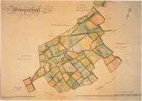
    Fig.6 Graigsallagh, from a volume of maps of the 'Manor of Maynooth'(1821) by Sherrard, Brassington and Green.(Courtesy of carton Desmesne)

    Fig.6 Graigsallagh, from a volume of maps of the ‘Manor of Maynooth'(1821) by Sherrard, Brassington and Green. (Courtesy of carton Desmesne)

    all elements of ostentatious showing-off of house and demesne in the highly status-sensitive society of the eighteenth century. The map shows the house and yards much as they are today. The walled garden is depicted with its interior detail. The lake had not yet been made—it had to await the damming of the Rye Water stream in the 1760s. Maynooth town (Fig.5) is shown at one of the major turning points in its history. What Rocque recorded was the almost medieval huddle of houses around the castle, with the main Galway road still in evidence passing through the toll gatehouse at the castle. However, at the east of the town, symbolically joining the avenue which led to Carton, is evidence of the beginning of the new town plan of Maynooth, with the newly laid-out main street as we have inherited it today. In what are now the grounds of Maynooth College, there are some curious ornamental (vegetable?) gardens reminiscent of earlier classical designs. Rocque’s legacy to Irish surveying and cartography is affirmed in a succession of later maps of Carton, which was possibly his first and certainly his most important private surveying undertaking. In 1769 his distinguished successor, Bernard Scalé, produced a superb map of the demesne at ten perches to the inch. In 1821, a volume of maps of the ‘Mannor of Maynooth’ (including Carton Park) was produced by Sherrard, Brassington and Greene (Fig.6). This was a leading firm of surveyors in early nineteenth-century Ireland and Thomas Sherrard had been a pupil of Scalé. Conclusion Although the eighteenth century is regarded as poorly supplied with primary sources, the growing accessibility of private estate papers is helping to expand the coverage and knowledge of this period. Estate surveys are an especially important components in these private collections. The changing landscape which they record is one of the most notable characteristics of the eighteenth-century ‘age of improvement’, because all the radical social and economic transformations of the age were inscribed indelibly on the Irish landcape of town and country. The later comprehensive maps of the Ordnance Survey recorded the landscape at the end of this cycle of change, though fortunately before the traumatic changes which accompanied the Famine. Although questions on the representativeness of extant estate maps are valid, those that have survived may provide valuable information on the extent and nature of enclosures, on changes in settlement patterns, on the evolution of placenames, on the development of road networks. Many of the surveys show house locations and although it is possible that many cabins were omitted or mapped inconsistently more systematic analysis of estate maps might throw light on the process of demographic expansion in the century before the Famine.   Origins : Co Clare Dimensions :65cm x 55cm
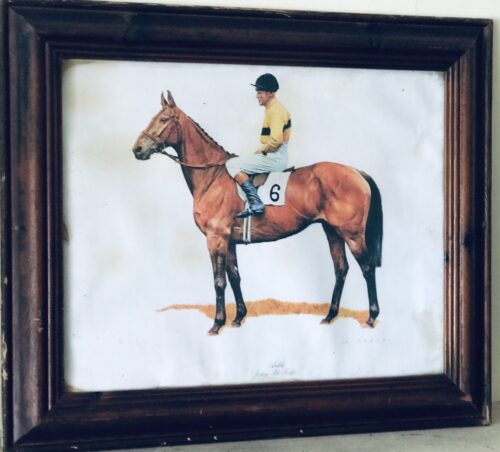
  • Beautiful portrait style print, in antique hardwood frame, depicting the great Arkle with regular jockey Pat Taafe on board wearing the distinctive yellow and black silks of Arkle's owner Anne,Duchess of Westminster. Arkle (19 April 1957 – 31 May 1970) was an Irish Thoroughbred racehorse. A bay gelding by Archive out of Bright Cherry, he was the grandson of the unbeaten (in 14 races) flat racehorse and prepotent sire Nearco. Arkle was born at Ballymacoll Stud, County Meath, by Mrs Mary Alison Baker of Malahow House, near Naul, County Dublin. He was named after the mountain Arkle in Sutherland, Scotland that bordered the Duchess of Westminster’s Sutherland estate. Owned by Anne Grosvenor, Duchess of Westminster, he was trained by Tom Dreaper at Greenogue, Kilsallaghan in County Meath, Ireland, and ridden during his steeplechasing career by Pat Taaffe. At 212, his Timeform rating is the highest ever awarded to a steeplechaser. Only Flyingbolt, also trained by Dreaper, had a rating anywhere near his at 210. Next on their ratings are Sprinter Sacre on 192 and then Kauto Star and Mill House on 191. Despite his career being cut short by injury, Arkle won three Cheltenham Gold Cups, the Blue Riband of steeplechasing, and a host of other top prizes. On 19th April, 2014 a magnificent  1.1 scale bronze statue was unveiled in Ashbourne, County Meath in commemoration of Arkle.In the 1964 Cheltenham Gold Cup, Arkle beat  Mill House (who had won the race the previous year) by five lengths to claim his first Gold Cup at odds of 7/4. It was the last time he did not start as the favourite for a race. Only two other horses entered the Gold Cup that year. The racing authorities in Ireland took the unprecedented step in the Irish Grand National of devising two weight systems — one to be used when Arkle was running and one when he was not. Arkle won the 1964 race by only one length, but he carried two and half stones more than his rivals. The following year's Gold Cup saw Arkle beat Mill House by twenty lengths at odds of 3/10. In the 1966 renewal, he was the shortest-priced favourite in history to win the Gold Cup, starting at odds of 1/10. He won the race by thirty lengths despite a mistake early in the race where he ploughed through a fence. However, it did not stop his momentum, nor did he ever look like falling. Arkle had a strange quirk in that he crossed his forelegs when jumping a fence. He went through the season 1965/66 unbeaten in five races. Arkle won 27 of his 35 starts and won at distances from 1m 6f up to 3m 5f. Legendary Racing commentator Peter O'Sullevan has called Arkle a freak of nature — something unlikely to be seen again. Besides winning three consecutive Cheltenham Gold Cups (1964, 1965, 1966) and the 1965 King George VI Chase, Arkle triumphed in a number of other important handicap chases, including the 1964 Irish Grand National (under 12-0), the 1964 and 1965 Hennessy Gold Cups (both times under 12-7), the 1965 Gallagher Gold Cup (conceding 16 lb to Mill House while breaking the course record by 17 seconds), and the 1965 Whitbread Gold Cup(under 12-7). In the 1966 Hennessy, he failed by only half a length to give Stalbridge Colonist 35 lb. The scale of the task Arkle faced is shown by the winner coming second and third in the two following Cheltenham Gold Cups, while in third place was the future 1969 Gold Cup winner, What A Myth. In December 1966, Arkle raced in the King George VI Chase at Kempton Park but struck the guard rail with a hoof when jumping the open ditch, which resulted in a fractured pedal bone; despite this injury, he completed the race and finished second. He was in plaster for four months and, though he made a good enough recovery to go back into training, he never ran again. He was retired and ridden as a hack by his owner and then succumbed to what has been variously described as advanced arthritis or possibly brucellosis and was put down at the early age of 13. Arkle became a national legend in Ireland. His strength was jokingly claimed to come from drinking 2 pints of Guinness  a day. At one point, the slogan Arkle for President was written on a wall in Dublin. The horse was often referred to simply as "Himself", and he supposedly received items of fan mail addressed to 'Himself, Ireland'. The Irish government-owned Irish National Stud, at Tully, Kildare, Co. Kildare, Ireland, has the skeleton of Arkle on display in its museum. A statue in his memory was erected in Ashbourne Co. Meath in April 2014. Origins :Co Limerick Dimensions :50cm x 60cm
  • A lovely little Bulmers moment here with its brightly coloured,ubiquitous Woodpecker ornament ( made from ceramic) Origins :Co Tipperary Dimensions: 20cm x 10cm x 10cm
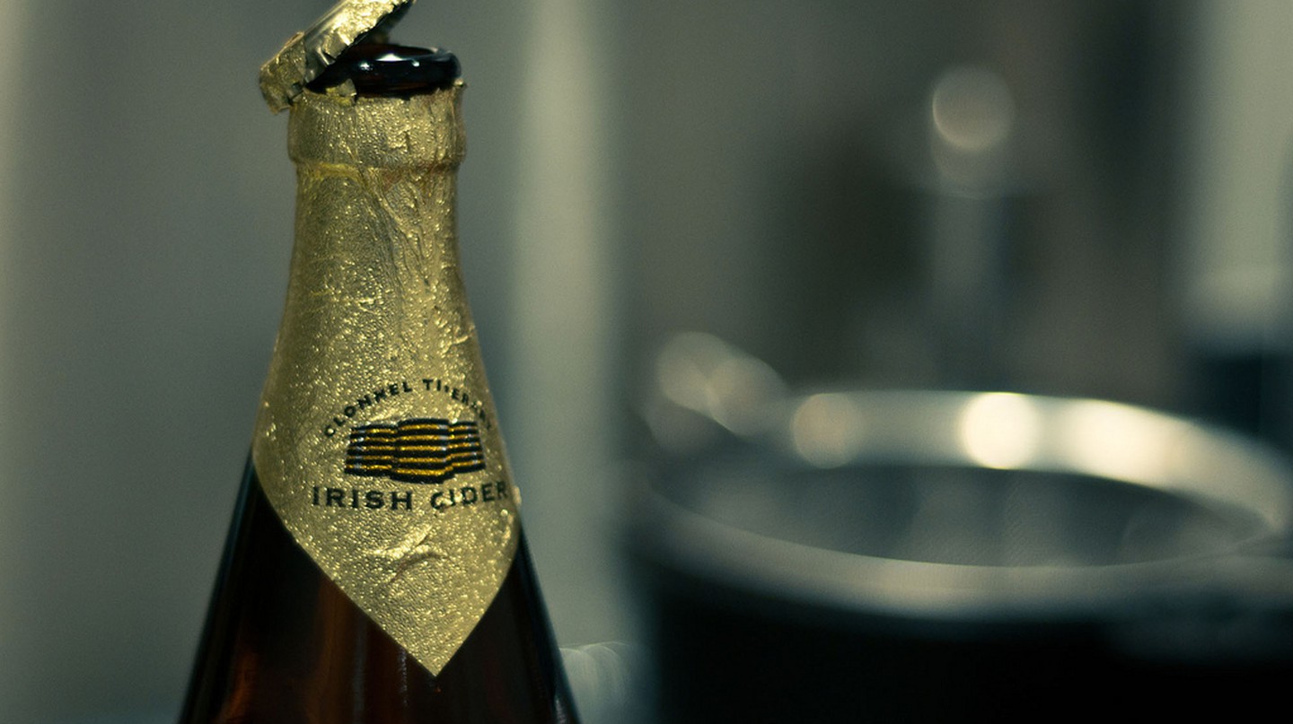
    Bulmers cider bottle | © Andy Rennie/Flickr
    While the brand of cider produced locally in County Tipperary may be known as Bulmers to the people of the Irish republic, it is referred to as Magners everywhere in the world. Established in 1935 by a local from the town of Clonmel named William Magner, the cider factory there was later bought out by cider-makers H. P. Bulmer in 1946 After buying an orchard in County Tipperary, William Magner began to produce his own Irish cider in the mid-1930s. In 1937, he teamed up with the well-established H.P. Bulmer company from England, acquiring the right to produce under the Bulmers name in Ireland, and the brand became more widespread. Following almost ten successful years in partnership, Magner decided to sell his remaining fifty percent stake to his colleagues, seeing the factory become known as Bulmers Ltd Clonmel.

    Unfortunately for H.P. Bulmer, it wasn’t long before the company again changed hands. Coming out on the losing end of a legal dispute with the creators of Babycham sparkling perry over a competing product, they were forced to sell Bulmers Clonmel during the 1960s. Having become part of the C&C Group – a soft drinks and cider company then jointly owned by Guinness and Allied Breweries – production of Irish Bulmers was moved five years later to a modern complex at Annerville, outside Clonmel.

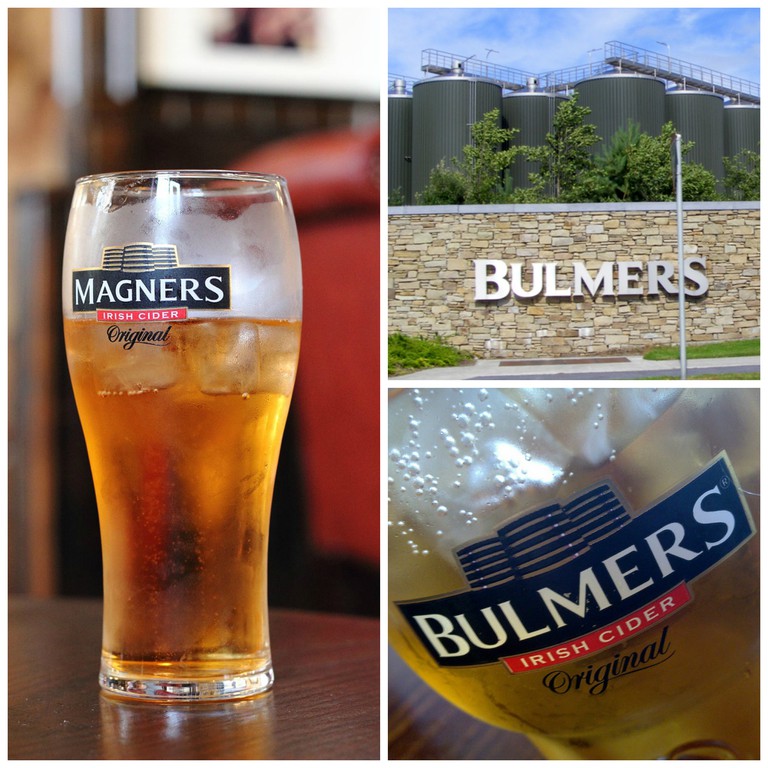
    Pint of Magners | © PierreSelim/WikiCommons / Bulmers factory, Clonmel | © Dimod61/WikiCommons / Bulmers | © Stephen Carter/Flickr

    With the Tipperary cider greatly exceeding sales expectations in Ireland, the C&C Group sought during the late 1990s to sell it outside of its home country, particularly in the burgeoning international Irish bar market. But as H.P. Bulmer still owned the rights to that name everywhere other than Ireland, they decided to call the brand after its original owner when exporting it – bringing Magners Irish cider first to Spain, then to Germanyand the UK. In spite of the the differing name, the two products are identical.

    Still produced at Annerville, today Irish Bulmers and Magners are made from 17 different kinds of apples, left to ferment and mature for up to two years. Continuing to grow in popularity, the cider can now be found in bars throughout Europe, Asia, North America, Australia and New Zealand.

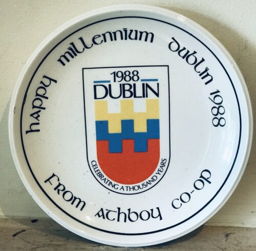
  • 20cm diametre Dublin In the 1980s and 1990s, a number of areas in the Republic of Ireland held year-long festivals commemorating historic anniversaries. The country was in an economic depression at the time and these were excuses for some civic pride; the anniversaries chosen were often rather arbitrary and were chosen by the relevant local authority to promote tourism. The "Dublin millennium" was proposed by city manager Frank Feely to be held in 1988, commemorating Gaelic King Mael Seachlainn II's conquest of the Viking city of Dublin.The corporation agreed in December 1985, prompting a historian to point out that the conquest had actually occurred in 989 and to suggest the year "was chosen quite arbitrarily for the 'millennium' because it is coming up soon, not long after the Galway 500 and the Cork 800". A commemorative 50 pence piece was minted for general circulationFounding and early history of Dublin
    The Dublin area circa 800
    The earliest reference to Dublin is sometimes said to be found in the writings of Claudius Ptolemaeus (Ptolemy), the Egyptian-Greek astronomer and cartographer, around the year 140, who refers to a settlement called Eblana. This would seem to give Dublin a just claim to nearly two thousand years of antiquity, as the settlement must have existed a considerable time before Ptolemy became aware of it. Recently, however, doubt has been cast on the identification of Eblana with Dublin, and the similarity of the two names is now thought to be coincidental. It is now thought that the Viking settlement was preceded by a Christian ecclesiastical settlement known as Duiblinn, from which Dyflin took its name. Beginning in the 9th and 10th century, there were two settlements where the modern city stands. The Viking settlement of about 841 was known as Dyflin, from the Irish Duiblinn (or "Black Pool", referring to a dark tidal pool where the River Poddle entered the Liffey on the site of the Castle Gardens at the rear of Dublin Castle), and a Gaelic settlement, Áth Cliath ("ford of hurdles") was further upriver, at the present day Father Mathew Bridge at the bottom of Church Street. The Celtic settlement's name is still used as the Irish name of the modern city, though the first written evidence of it is found in the Annals of Ulster of 1368. The modern English name came from the Viking settlement of Dyflin, which derived its name from the Irish Duiblinn. The Vikings, or Ostmen as they called themselves, ruled Dublin for almost three centuries, although they were expelled in 902 only to return in 917 and notwithstanding their defeat by the Irish High King Brian Boru at the Battle of Clontarf in 1014. From that date, the Norse were a minor political force in Ireland, firmly opting for a commercial life. Viking rule of Dublin would end completely in 1171 when the city was captured by King Dermot MacMurrough of Leinster, with the aid of Cambro-Norman mercenaries. An attempt was made by the last Norse King of Dublin, Ascall mac Ragnaill, to recapture the city with an army he raised among his relations in the Scottish Highlands, where he was forced to flee after the city was taken, but the attempted reconquest failed and Ascall was killed.
    Skudelev II, a large Viking Age warship built in the Dublin area c. 1042
    The Thingmote was a raised mound, 40-foot (12 m) high and 240-foot (73 m) in circumference, where the Norsemen assembled and made their laws. It stood on the south of the river, adjacent to Dublin Castle, until 1685.[4] Viking Dublin had a large slave market. Thralls were captured and sold, not only by the Norse but also by warring Irish chiefs.b Dublin celebrated its millennium in 1988 with the slogan Dublin's great in '88'. The city is far older than that, but in that year, the Norse King Glun Iarainnrecognised Máel Sechnaill II (Máel Sechnaill Mór), High King of Ireland, and agreed to pay taxes and accept Brehon Law.a That date was celebrated, but might not be accurate: in 989 (not 988), Mael Seachlainn laid siege to the city for 20 days and captured it. This was not his first attack on the city.[citation needed] Dublin became the centre of English power in Ireland after the Norman invasion of the southern half of Ireland (Munster and Leinster) in 1169–71, replacing Tara in Meath – seat of the Gaelic High Kings of Ireland – as the focal point of Ireland's polity. On 15 May 1192 Dublin's first written Charter of Liberties was granted by John, Lord of Ireland, and was addressed to all his "French, English, Irish and Welsh subjects and friends". On 15 June 1229 his son Henrygranted the citizens the right to elect a mayor who was to be assisted by two provosts.[5] By 1400, however, many of the Anglo-Norman conquerors were absorbed into the Gaelic culture, adopting the Irish language and customs, leaving only a small area of Leinster around Dublin, known as the Pale, under direct English control.   Origins : Dublin Dimensions :
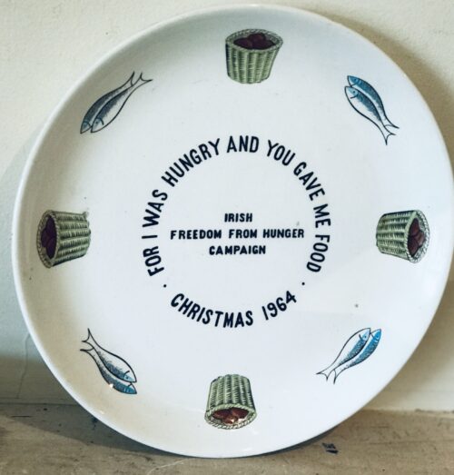
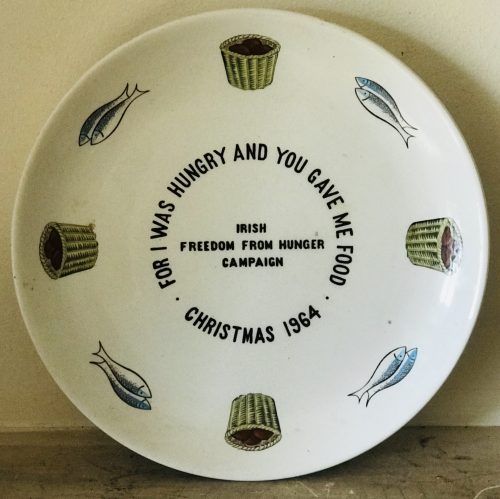
  • Christmas 1964 Irish Freedom from Hunger Arklow Pottery Plate. 25cm diametre
Go to Top