• cm x cm  Askeaton Co Limerick

    ‘Our seducers were our accusers’: the lurid tales of members of Askeaton Hellfire Club

    The ruins of Askeaton Hellfire Club on an island in the River Deel, with the ruins of the Desmond Castle in the background (Photograph: Patrick Comerford, 2017) Patrick Comerford The ruins of Limerick Hellfire Club stand beside the ruins of the Desmond Castle on the island in the middle of the River Deel. As the fast-flowing waters of the river thunder past, making their way under the old narrow bridge, these ruins appear like a benign presence in the heart of the town, especially in the early evening as the sun sets behind them and the rooks and herons hover above the remains of this centuries-old crumbling structures. The ruins of the Hellfire Club stand within the bailey of Askeaton Castle. They date from 1636-1637, when this building was first erected as a detached barracks or tower. The barracks or tower was built by the builder and designer, Andrew Tucker, for Richard Boyle (1566-1643), the 1st Earl of Cork, who had recently acquired Askeaton Castle. The tower was built with battered walls with cut stone quoins, and the remains of a three-bay was built on top of the battered base later, some time in the mid-18th century. There is a bow to the south elevation of the house and a shallow projecting end-bay to the north elevation. The house is roofless, with a limestone eaves course. The course rubble limestone walls have tolled quoins, a brick stringcourse and brick quoins to the upper floors. There are square-headed door openings to the north elevation, a square-headed window opening to the bow with a brick architrave, and camber-headed window openings to the west, with brick voussoirs. The round-headed window opening to the east elevation has a brick surround, flanked by round-headed niches with brick surrounds and a continuous brick sill course. By 1740, the building belonged to the St Leger family, who may have engaged John Aheron to design the bow-sided house which was built on top of the base of the barracks. By then, this was the meeting place of the Askeaton Hell Fire Club, and the building was probably used by the club until the end of the 18th century. The club in Askeaton traced its origins to the first Hellfire Club, formed in 1719 by Philip Wharton (1698-1731), 1st Duke of Wharton. Wharton was a rake who gamble away Rathfarnham Castle in Dublin and most of his inheritance. In 1726, he married Maria Theresa O’Beirne (sometimes known as Maria Theresa Comerford). When he was in the advanced stages of alcoholism, the couple moved to a Cistercian abbey in Catalonia, where he died in 1731. His widow returned to London, and after his will was proved in court she lived comfortably in London society. The club continued long after Wharton’s death, and the club in Askeaton was founded around 1736-1740. Known as a satirical gentlemen’s club, the revelries of its members shocked their neighbours and the outside world. The two other clubs in Ireland were based on Montpelier Hill, south of Tallaght, and near Clonlara, Co Clare. In his recent book Blasphemers & Blackguards, The Irish Hellfire Clubs (2012), David Ryan examines the stories of these clubs. But, while local folklore recalls lurid tales of outrageous rituals, there is little actual information or evidence of the activities of the Askeaton Hellfire Club, and the name and supposedly lurid activities may have been opportunities to slight the church and to snub clerical authority, or mere excuses to hide their debauchery during evenings of wine, women and song.
    James Worsdale’s painting of the members of the Askeaton Hellfire Club One tradition recalls how a member of the club was thrown from one of the windows into the River Deel below during the course of a ‘drunken frolic.’ Evidence of the club and its members survives in a painting by James Worsdale (1692-1767) from sometime between 1736 and 1740. This painting shows a group of club members in Askeaton drinking, smoking and in conversation. Bottles of wine sit on a rack in the foreground, and there is a large bowl of punch on the table. Eleven men and one woman, as well as a boy, fill the painting. Some of the figures that have been identified include: Edward Croker of Ballingarde, his son John (died 1804); Wyndham Quin of Adare, father of the 1st Earl of Dunraven; Thomas Royce of Nantenan, near Askeaton; John Bayley of Debsborough, Nenagh, Co Tipperary; and Henry Prittie, father of Henry Prittie (1743-1801), father of Lord Dunalley. Worsdale, who was a founding member of the Dublin Hellfire Club, is on the far left of the painting, trying to attract the attention of the only woman in the painting. Most critics identify this woman as Margaret Blennerhassett, who was known as Celinda and who was the wife of Arthur Blennerhassett, a magistrate, of Riddlestown Park, Rathkeale. She was born Margaret Hayes, the eldest daughter of Jeremiah Hayes of Cahir Guillamore, Bruff. Celinda is said to have been the only woman who ever became a member of the Askeaton Hellfire Club. The story is told that in her curiosity she tried to find what the men did during their meetings at the club. She hid herself in the meeting room before the members arrived, and when they discovered her she was formally inducted as a member to ensure her silence. Later, her husband drowned in a boating tragedy in the Lakes of Killarney in 1775. Some critics, however, have identified the woman in this painting as Laetitia Pilkington, alongside her husband, the Revd Matthew Pilkington (1701-1774), one-time friends of Jonathan Swift, Dean of Saint Patrick’s Cathedral, Dublin. This would date the painting from some time before 1738. Matthew Pilkington moved to London, where he became friends with the painter James Worsley, led a dissolute life, divorced Laetitia, and was jailed in 1734. When he returned to Ireland, he enjoyed the patronage of Archbishop Michael Cobbe of Dublin and the Cobbe family of Newbridge House, Donabate. Laetitia Pilkington (1709-1750), was the daughter of a Dublin obstetrician, Dr John van Lewen. After Matthew fabricated the circumstances that led to their divorce, she was arrested for a debt of £2 and ended up in a debtors’ prison in London. If she was forced into discreet prostitute to earn a living later in life, she was also scathingly critical of the clergy of day. Speaking probably from the experience of her husband’s own lifestyle, she said ‘the holiness of their office gives them free admittance into every family’ and they abuse this so that ‘they are generally the first seducers of innocence.’ ‘Our seducers were our accusers,’ she wrote.
    The monument in Saint Ann’s Church, Dawson Street, Dublin, commemorating Laetitia Pilkington (Photograph: Patrick Comerford, 2017) When Laetitia Pilkington died in 1750, a monument was erected in Saint Ann’s Church, Dawson Street, Dublin, with clear references to the sufferings she had endured at the hands of her merciless husband. Less than a month after her death, Matthew Pilkington married his mistress Nancy Sandes. In 1811, an evangelical magazine published an obituary of Captain Perry, a carousing individual and likely member of a Hellfire Club. After a short lifetime of excessive living and radical thinking, he died an early death as he struggled to repent. It was a warning to readers of the dangers of being involved in such circles. The building was abandoned by the club sometime around 1840, and the club is inaccessible to the public, as the Office of Public Works continues work at stabilising the building. The Limerick Leader in May 1958 that James Worsdale’s painting of the members of the Askeaton Hellfire Club was being offered for sale to Limerick City Council for £350. It is now in the National Gallery of Ireland. Although the ruins of the Askeaton Hellfire Club have fallen into disrepair, the overall original form of this building is easily discerned, as are features such as the door and window openings. It retains many well-crafted features such as the brick window surrounds and limestone battered walls, and the high roof and the tall chimneys are of interest. The building has a curved bow at one side of each of the building’s two principal fronts, and one of them has a Venetian window. If, as is possible, the house dates from the 17th century, then this could be one of the earliest known examples of a Venetian window on a curve, not just in Ireland but anywhere else in Europe – which could just make it a far more interesting building than the myths and legends surrounding its rakish revellers.
    Sunset at Askeaton Castle and Hellfire Club, seen from Saint Mary’s Church (Photograph: Patrick Comerford, 2017)
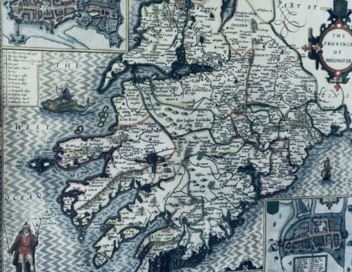
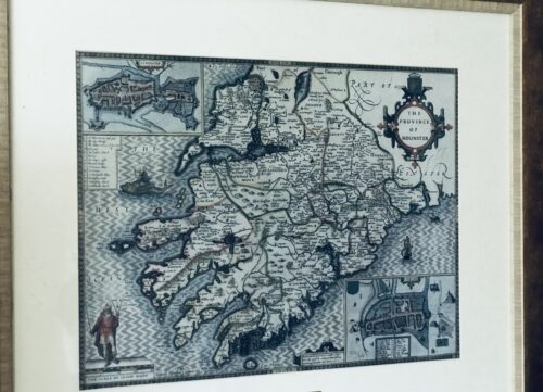
  • Fascinating map from 1610 as by the renowned cartographer John speed of the Province of Mounster(Munster!)-comprising the counties of Tipperary,Clare,Limerick,Cork,Kerry & Waterford.Includes miniature city layouts of both Limerick & Cork. 52cm x 65cm   Beaufort Co Kerry John Speed (1551 or 1552 – 28 July 1629) was an English cartographer and historian. He is, alongside Christopher Saxton, one of the best known English mapmakers of the early modern period.

    Life

    Speed was born in the Cheshire village of Farndon and went into his father Samuel Speed's tailoring later in life. While working in London, Speed was a tailor and member of a corresponding guild, and came to the attention of "learned" individuals. These individuals included Sir Fulke Greville, who subsequently made him an allowance to enable him to devote his whole attention to research. By 1598 he had enough patronage to leave his manual labour job and "engage in full-time scholarship". As a reward for his earlier efforts, Queen Elizabethgranted Speed the use of a room in the Custom House. Speed, was, by this point, as "tailor turned scholar" who had a highly developed "pictorial sense". In 1575, Speed married a woman named Susanna Draper in London, later having children with her. These children definitely included a son named John Speed, later a "learned" man with a doctorate, and an unknown number of others, since chroniclers and historians cannot agree on how many children they raised. Regardless, there is no doubt that the Speed family was relatively well-off. By 1595, Speed published a map of biblical Canaan, in 1598 he presented his maps to Queen Elizabeth, and in 1611–1612 he published maps of Great Britain, with his son perhaps assisting Speed in surveys of English towns. At age 77 or 78, in August 1629, Speed died. He was buried alongside his wife in London's St Giles-without-Cripplegate church on Fore Street. Later on, a memorial to John Speed was also erected behind the altar of the church.According to the church's website, "[His was] one of the few memorials [in the church] that survived the bombing" of London during The Blitz of 1940–1941 ... The website also notes that "[t]he cast for the niche in which the bust is placed was provided by the Merchant Taylors' Company, of which John Speed was a member". His memorial brass has ended up on display in the Burrell Collection near Glasgow.

    Works

    Speed drew historical maps in 1601 and 1627 depicting the invasion of England and Ireland, depictions of the English Middle Ages, along with those depicting the current time, with rough originals but appealing, colourful final versions of his maps. It was with the encouragement of William Camden that Speed began his Historie of Great Britaine, which was published in 1611. Although he probably had access to historical sources that are now lost to us (he certainly used the work of Saxton and Norden), his work as a historian is now considered secondary in importance to his map-making, of which his most important contribution is probably his town plans, many of which provide the first visual record of the British towns they depict.In the years leading up to this point, while his atlas was being compiled, he sent letters to Robert Cotton, part of the British government to ask for assistance in gathering necessary materials.
    In 1627 George Humble published the Prospect of the Most Famous Parts of the World, printed by John Dawson. This is the world map from this atlas with John Speed's name in the title, but not attributed to Speed's authorship.
    His atlas The Theatre of the Empire of Great Britaine was published in 1611 and 1612, and contained the first set of individual county maps of England and Wales besides maps of Ireland and a general map of Scotland. Tacked onto these maps was an introduction at the beginning when he addressed his "well affected and favourable reader", which had numerous Christian and religious undertones, admitting that there may be errors, but he made it the best he could, and stated his purpose for the atlas:
    my purpose...is to shew the situation of every Citie and Shire-town only [within Great Britain]...I have separated...[with] help of the tables...any Citie, Towne, Borough, Hamlet, or Place of Note...[it] may be affirmed, that there is not any one Kingdome in the world so exactly described...as is...Great Britaine...In shewing these things, I have chiefly sought to give satisfaction to all.
    With maps as "proof impressions" and printed from copper plates, detail was engraved in reverse with writing having to be put on the map the correct way, while speed "copied, adapted and compiled the work of others", not doing much of the survey work on his own, which he acknowledged.The atlas was not above projections of his political opinions" Speed represented King James I as one who unified the "Kingdoms of the British isles". In 2016, the British Library published a book, introduced by former MP Nigel Nicolson and accompanied by commentaries by late medieval and early modern historian Alasdair Hawkyard, which reprinted this collection of maps on the British Isles, showing that Speed had drawn maps of areas ranging from Bedfordshire to Norfolk and Wales. Most, but not all, of the county maps have town plans on them; those showing a Scale of Passes being the places he had mapped himself. In 1627, two years before his death, Speed published Prospect of the Most Famous Parts of the World which was the first world atlas produced by an Englishman, costing 40 shillings, meaning that its circulation was limited to "richer customers and libraries", where many survive to this day. There is a fascinating text describing the areas shown on the back of the maps in English, although a rare edition of 1616 of the British maps has a Latin text – this is believed to have been produced for the Continental market. Much of the engraving was done in Amsterdam at the workshop of a Flemish man named Jodocus Hondius, with whom he collaborated with from 1598 until 1612, with Hondius's sudden death, a time period of 14 years.His maps of English and Welsh counties, often bordered with costumed figures ranging from nobility to country folk, are often found framed in homes throughout the United Kingdom. In 1611, he also published The genealogies recorded in the Sacred Scriptures according to euery family and tribe with the line of Our Sauior Jesus Christ obserued from Adam to the Blessed Virgin Mary, a biblical genealogy, reprinted several times during the 17th century. He also drew maps of the Channel Islands, Poland, and the Americas, the latter published only a few years before his death. On the year of his death, yet another collection of maps of Great Britain he had drawn the year before were published. Described as a "Protestant historian", "Puritan historian" or "Protestant propagandist" by some, Speed wrote about William Shakespeare, whom he called a "Superlative Monster" because of certain plays, Roman conquest, history of Chester, and explored "early modern concepts of national identity". As these writings indicate, he possibly saw Wales as English and not an independent entity. More concretely, there is evidence that Speed, in his chronicling of history, uses "theatrical metaphors" and his developed "historiographic skill" to work while he repeats myths from medieval times as part of his story.

    Legacy

    Since his maps were used in many high circles, Speed's legacy has been long-reaching. After his death, in 1673 and 1676, some of his other maps on the British isles, the Chesapeake Bay region, specifically of Virginia and Maryland, the East Indies, the Russian Empire then ruled by Peter the Great, Jamaica, and Barbados, among other locations.With these printings and others, Speed's maps became the basis for world maps until at least the mid-eighteenth century, with his maps reprinted many times, and served as a major contribution to British topography for years to come. In later years, Speed would be called "our English Mercator", a person of "extraordinary industry and attainments in the study of antiques", an "honest and impartial historian", a "faithful Chronologer", and "our Cheshire historian...a scholar...a distinguished writer on history".He was also called a "celebrated chronologer and histographer", "cartographer", and much more. Even today, prints of his "beautiful maps" can be found in living rooms across the world, and sell for hundreds of thousands of pounds in rare art and map auctions, drawing in map collectors across the globe.Additionally, some use John Speed's maps, and connected commentary, to interpret William Shakespeare's plays; however, Speed did not like Shakespeare in the slightest, and called him a "papist".
  • Commemorative team photo of the 3 in a row winning Kerry Footballers 1978,1979 & 1§980 Sneem Co Kerry  Dimensions :63cm x 45cm  

    T

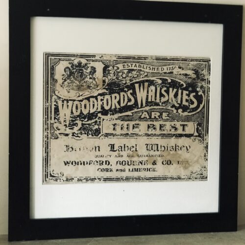
  • Beautifully reproduced Woodford,Bourne & Co.Ltd Whiskey mirror. 50cm x 60cm Limerick Woodford Whiskies traded in Cork city for over 250 years. The warehouse was the hub of the companies bottling, storage and distribution operations supplying four shops in Cork and one in Limerick. The building was constructed between 1873 and 1875 at a cost of £4,500. When completed in 1875 the building was considered one of the finest in the city and today continues to be a listed building. The building with its cut limestone frontage has thick floor and roof beams made from imported Canadian white pine to support the weight of the full casks of wine and spirits stored in the warehouse. On the ground floor, you can still see the vaulted ceilings of the original cellars and throughout the building the thick stone walls built with master craftsmanship are on view everywhere. Over 10 years supply of whiskey, casks containing over a million bottles of wine, sherries and ports and more than 50,000 gallons of choice Cork and Dublin whiskies, Scotch whiskies and fine French brandies were all stored from seven to 10 years in wet and dry cellars.
    Woodford Bourne
    Subsequent to a fire the building was restored and in 2001 received 1st Place in the Cork Corporation 'Better Building Award' for the restoration of a historic building. A book entitled 'The History of Woodford Bourne', written by David Nicholson a member of the family, was successfully launched in the warehouse in 2005.  
  • Out of stock
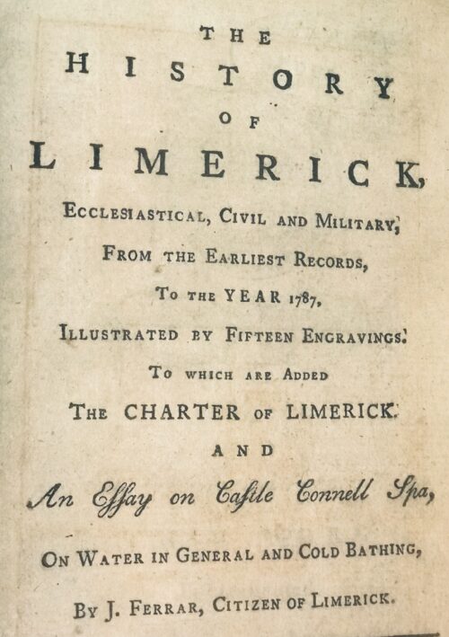
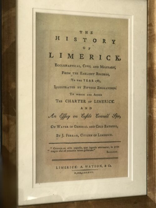
    Ferrars History of Limerick was first published in 1787.There are very few copies still in existence and these 5 prints were generously taken from 16 original engravings in the first edition .They depict the Siege of Limerick in 1691,St Marys Cathedral,De Burgos Castle in Castleconnell,The Exchange building and the first page of the book. 35cm x 40cm  Limerick  
    The History of Limerick by James Ferrar published in 1787 is a history of Limerick city from ancient times until the late 18th century. Limerick was an important medieval stronghold, became an important port and trading centre, was subject to a series of sieges in the 17th century and finally experienced a brief golden age of prosperity during the Georgian period of the late 18th century. Limerick or Luimneach was an ancient settlement long before the Vikings captured it and established their own town there in the 9th century. They used it as a base for trade and also to launch raids up the River Shannon against monastic sites like Clonmacnoise and other wealthy Christian centres. However in the 11th century the last Viking king of Limerick was defeated by King Brian Boru. In 1174, the Norman conquerors who had already seized Dublin , Leinster and Munster captured the city of Limerick . It was given its city charter by King Richard I in 1197 and a castle fortress was built by King John about 1200. The medieval city featured a walled town known as Englishtown on the north side of the River Shannon. Irishtown was inhabited by the Irish and Vikings was on the south side of the river. Both were eventually walled and linked by bridges over the Shannon . Limerick would retain formidable defenses until the 17th century when it experienced four separate sieges during the period of the English Civil War and the Williamite Wars. Catholic rebels forced the English garrison to surrender in 1642 and a Parliamentarian Army in turn forced a Catholic and Royalist garrison to surrender in 1651. It was twice besieged in 1690 and 1691 by the forces of William III of Orange who forced Jacobins fighting on the sides of the Catholic James II to surrender and go into exile. From the late 17th to the 19th centuries an Anglo-Irish Protestant elite controlled Ireland . In Limerick in the late 1700s Limerick merchants prospered and Edmund Pery, 1st Viscount Pery had much of the south side of the city redesigned with a grid of Georgian brick terraces and neo-classical stone buildings. The Georgian area still survives in the 21st century and Prey Square is named in Edmund Prey's honour. Unfortunately the Irish economy declined in the early 19th century as the Irish Parliament was switched from College Green, Dublin to the House of Commons in London and Ireland remained a near feudal agricultural society as Britain rapidly industrialised. Like Dublin , Limerick 's best days were behind it as slums flourished and in the 1840s the city population swelled as the poor fled from the land after the failure of the potato crop.  
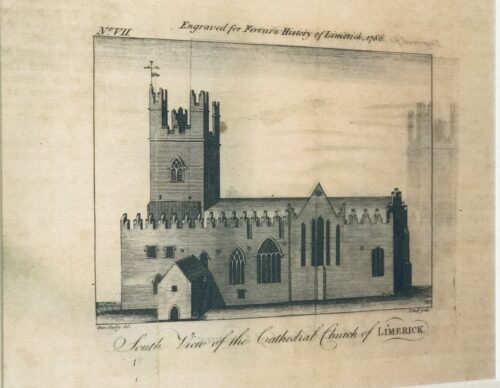
  • St Marys Cathedral from Ferrars History of Limerick, first published in 1787.There are very few copies still in existence and these 5 prints were generously taken from 16 original engravings in the first edition 35cm x 40cm  Limerick Limerick Cathedral (Saint Mary's) is dedicated to the Blessed Virgin Mary and was founded in 1168 and is the oldest building in Limerick which is in use. It has the only complete set of misericords left in Ireland. In 1111, the Synod of Ráth Breasail decided that "Saint Mary's church" would become the cathedral church of the Diocese of Limerick. According to tradition, Domnall Mór Ua Briain, the last King of Munster, founded the present cathedral on the site of his palace on King's Island in 1168.[3] The palace had been built on the site of the Viking meeting place, or "Thingmote" – the Vikings' most westerly European stronghold.[1] This had been the centre of government in the early medieval Viking city. Parts of the palace may be incorporated into the present structure of the cathedral, most prominently the great west door, which is claimed to have been the original main entrance to the royal palace.The west door is now only used on ceremonial occasions. The bishops of Limerick have for centuries knocked on this door and entered by it as part of their installation ceremony. According to tradition, during the many sieges of Limerick the defenders of the city used the stones around the west door to sharpen their swords and arrows, and the marks they made in the stonework can be seen there today. The tower of Saint Mary's Cathedral was added in the 14th century. It rises to 120 feet (36.58 meters), containing a peal of 8 bells, of which 6 were cast by John Taylor & Co, Loughborough, and 2 cast in Whitechapel, London. The tower also contains a stationary service bell, which can be rung from the ground floor.

    Notable burials

    From the Irish Reformation to the 19th century

    Altar of the cathedral
    There are five chandeliers which hang from the ceiling. These are only lit on special occasions. The larger three of the five were made in Dublin and presented in 1759 by the Limerick Corporation. The belfry holds a peal of eight bells, six of which were presented by William Yorke, mayor of Limerick, in 1673. An active team of bell ringers travels the country to compete with other campanologists.Saint Mary's received its organ in 1624, when Bishop Bernard Adams donated one. It has been rebuilt over the centuries and was most recently renovated in 1968 and 2005. In 1620 the English-born judge Luke Gernon, a resident of Limerick, wrote a flattering description of the cathedral: "not large, but lightsome, and by the providence of the Bishop fairly beautified within, and as gloriously served with singing and organs". During the Irish Confederacy wars, the cathedral was briefly transferred to Roman Catholic hands. The bishop of Limerick, Richard Arthur, was buried in the cathedral in 1646.
    Choir misericords
    In 1651, after Oliver Cromwell's forces captured Limerick, the cathedral was used as a stable by the parliamentary army. This misuse was short lived, but was a similar fate to that suffered by some of the other great cathedrals during the Cromwellian campaign in Ireland. The troops also removed the cathedral's original 13 ft Pre-Reformation high altar from the cathedral. The altar was only reinstated in the 1960s. It is the largest such altar in Ireland and the UK, carved from a single limestone block. The altar is used for communion services at major festivals and remains in its historic location in what is now the chapel of the Virgin Mary or Lady Chapel. In 1691, the cathedral suffered considerable damage, particularly on the east end, during the Williamite Siege of Limerick.After the Treaty of Limerick, William granted £1,000 towards repairs. There are cannonball from 1691 in the Glentworth Chapel/Saint George's Chapel inside.

    From the 19th century to the 20th century

    Postage Stamp from 1968
    In 1968, the Irish Government commissioned two postage stamps to commemorate the cathedral's 800 year anniversary. A picture of one of the stamps is displayed on this page. In 1991, there was a large £2.5 million restoration programme which was completed in 1996 with the excavation and re-laying of the floors as well as the installation of underfloor central heating. Restoration continues today to a lesser degree.

    From the 20th century to the 21st century

    Today the cathedral is still used for its original purpose as a place of worship and prayer for everybody. It is also the 3rd biggest tourist attraction in Limerick. It is open to the public every day from 9:00 am to 4:45 pm. For Tourists there is a €5 admission charge upon entry. This money is essential for the upkeep of the building, and without it, the cathedral simply could not function. Following the retirement of the Very Rev'd Maurice Sirr on 24 June 2012, Bishop Trevor Williams announced the appointment of the Reverend Sandra Ann Pragnell as Dean of Limerick and Rector of Limerick City Parish. She was the first female dean of the cathedral and rector of Limerick City Parish, and retired in January 2017. It was announced on 27 August 2017, that the Reverend Canon Niall James Sloane was to become the 63rd Dean of Limerick and the new rector of Limerick City Parish; with his installation and institution taking place on 21 October 2017 in the cathedral. The cathedral grounds holds United Nations Memorial Plaque with the names of all the Irish men who died while serving in the United Nations Peacekeepers.  
    The History of Limerick by James Ferrar published in 1787 is a history of Limerick city from ancient times until the late 18th century. Limerick was an important medieval stronghold, became an important port and trading centre, was subject to a series of sieges in the 17th century and finally experienced a brief golden age of prosperity during the Georgian period of the late 18th century. Limerick or Luimneach was an ancient settlement long before the Vikings captured it and established their own town there in the 9th century. They used it as a base for trade and also to launch raids up the River Shannon against monastic sites like Clonmacnoise and other wealthy Christian centres. However in the 11th century the last Viking king of Limerick was defeated by King Brian Boru. In 1174, the Norman conquerors who had already seized Dublin , Leinster and Munster captured the city of Limerick . It was given its city charter by King Richard I in 1197 and a castle fortress was built by King John about 1200. The medieval city featured a walled town known as Englishtown on the north side of the River Shannon. Irishtown was inhabited by the Irish and Vikings was on the south side of the river. Both were eventually walled and linked by bridges over the Shannon . Limerick would retain formidable defenses until the 17th century when it experienced four separate sieges during the period of the English Civil War and the Williamite Wars. Catholic rebels forced the English garrison to surrender in 1642 and a Parliamentarian Army in turn forced a Catholic and Royalist garrison to surrender in 1651. It was twice besieged in 1690 and 1691 by the forces of William III of Orange who forced Jacobins fighting on the sides of the Catholic James II to surrender and go into exile. From the late 17th to the 19th centuries an Anglo-Irish Protestant elite controlled Ireland . In Limerick in the late 1700s Limerick merchants prospered and Edmund Pery, 1st Viscount Pery had much of the south side of the city redesigned with a grid of Georgian brick terraces and neo-classical stone buildings. The Georgian area still survives in the 21st century and Prey Square is named in Edmund Prey's honour. Unfortunately the Irish economy declined in the early 19th century as the Irish Parliament was switched from College Green, Dublin to the House of Commons in London and Ireland remained a near feudal agricultural society as Britain rapidly industrialised. Like Dublin , Limerick 's best days were behind it as slums flourished and in the 1840s the city population swelled as the poor fled from the land after the failure of the potato crop.  
  • Out of stock
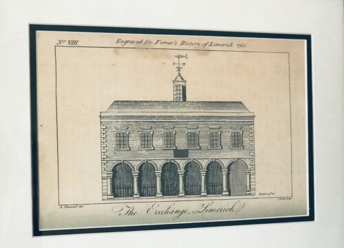
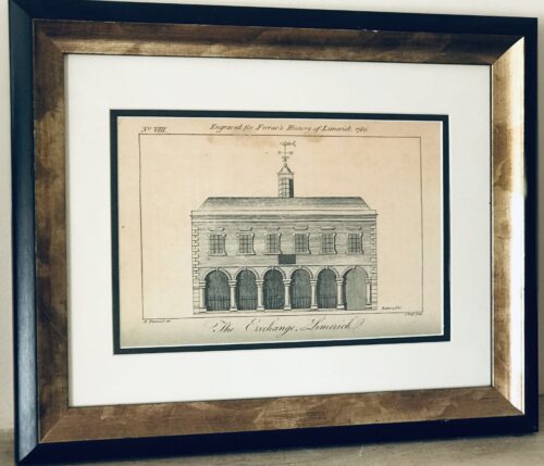
    Superb print of The Exchange Limerick from Ferrars History of Limerick,first published in 1787.There are very few copies still in existence and these 5 prints were generously taken from 16 original engravings in the first edition . 35cm x 40cm  Limerick  
    rcaded six-bay single-storey limestone exterior wall forming the remains of the former Exchange, originally built in 1673, rebuilt in 1702 and again in between 1777-78. Forms part of the wall which surrounds Saint Mary's Cathedral graveyard and faces onto Nicholas Street. Historically in use as an evening national school. Now much obscured by vegetative growth. The blind arcade of seven arches is formed by half-engaged Tuscan columns standing on limestone base, breaking to centre arch and end bay to west. Profiled archivolts unseen. Entablature to parapet obscured. Roughly squared and coursed rubble limestone infill between arches. At either end is an ashlar limestone pier engaged with end columns, giving strength of composition to the broad intercolumniation. Plaque to Cathedral wall reads: This Exchange Was Rebuilt At Expense Of The Corporation Of Limerick The First Year Of The Reign Of Queen Anne Anno Dom 1702 William Davis Esquire Mayor Rawley Colroys Robert Wilkinson Sheriffs'.

    Appraisal

    What remains of this impressive architectural composition is an important and enriching palimpsest to the site and complex of Saint Mary's Cathedral. The secular use of which shows the economic importance of the building given its proximity to the cathedral. Henry Denmead was responsible for the reworking in 1777-78. James Pain was paid £432.17s 5d for repairs and alterations in April 1815, while George Richard Pain carried out further repairs in June 1819 to the cost of £182.1s 2½ d. On the 1872 Ordnance Survey the building was in use as a national school, and the floor plan represented was of a single unified space opening onto Nicholas Street and three small secondary rooms to the rear. A passage or corridor to the west appears to have given access to the Church grounds, and the building to the rear looked onto a walled graveyard. A lane, now gone, called Grid Iron Lane, ran along the east side elevation of the structure, returning at right angles to meet Bridge Street.

     
    The History of Limerick by James Ferrar published in 1787 is a history of Limerick city from ancient times until the late 18th century. Limerick was an important medieval stronghold, became an important port and trading centre, was subject to a series of sieges in the 17th century and finally experienced a brief golden age of prosperity during the Georgian period of the late 18th century. Limerick or Luimneach was an ancient settlement long before the Vikings captured it and established their own town there in the 9th century. They used it as a base for trade and also to launch raids up the River Shannon against monastic sites like Clonmacnoise and other wealthy Christian centres. However in the 11th century the last Viking king of Limerick was defeated by King Brian Boru. In 1174, the Norman conquerors who had already seized Dublin , Leinster and Munster captured the city of Limerick . It was given its city charter by King Richard I in 1197 and a castle fortress was built by King John about 1200. The medieval city featured a walled town known as Englishtown on the north side of the River Shannon. Irishtown was inhabited by the Irish and Vikings was on the south side of the river. Both were eventually walled and linked by bridges over the Shannon . Limerick would retain formidable defenses until the 17th century when it experienced four separate sieges during the period of the English Civil War and the Williamite Wars. Catholic rebels forced the English garrison to surrender in 1642 and a Parliamentarian Army in turn forced a Catholic and Royalist garrison to surrender in 1651. It was twice besieged in 1690 and 1691 by the forces of William III of Orange who forced Jacobins fighting on the sides of the Catholic James II to surrender and go into exile. From the late 17th to the 19th centuries an Anglo-Irish Protestant elite controlled Ireland . In Limerick in the late 1700s Limerick merchants prospered and Edmund Pery, 1st Viscount Pery had much of the south side of the city redesigned with a grid of Georgian brick terraces and neo-classical stone buildings. The Georgian area still survives in the 21st century and Prey Square is named in Edmund Prey's honour. Unfortunately the Irish economy declined in the early 19th century as the Irish Parliament was switched from College Green, Dublin to the House of Commons in London and Ireland remained a near feudal agricultural society as Britain rapidly industrialised. Like Dublin , Limerick 's best days were behind it as slums flourished and in the 1840s the city population swelled as the poor fled from the land after the failure of the potato crop.  
  • Out of stock
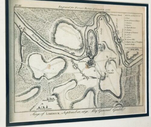
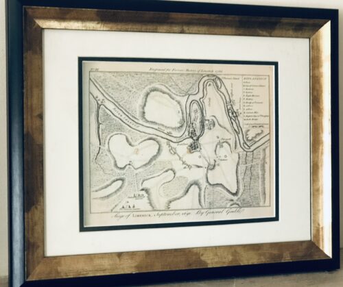
    The Siege of Limerick 1691 from the definitive Ferrars History of Limerick was first published in 1787 There are very few copies still in existence and these 5 prints were generously taken from 16 original engravings in the first edition . 35cm x 40cm  Limerick The Siege of Limerick in western Ireland was a second siege of the town during the Williamite War in Ireland (1689–1691). The city, held by Jacobite forces was able to beat off a Williamite assault in 1690. However, after a second siege in August–October 1691, it surrendered on favourable terms. By the time of the second siege, the military situation had turned against the Jacobites; their main force had been badly defeated at the Battle of Aughrim in July, with over 4,000 killed, including their commander, the Marquis de St Ruth, and thousands more either taken prisoner or deserted. The town of Galway capitulated in July 1691; its Jacobite garrison was accorded 'all the honours of war,' which allowed them to retain their weapons and receive a free pass to Limerick.
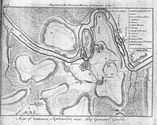
    Siege of Limerick 1691, map.
    However, although its defences had been considerably strengthened since 1690, morale was now much lower after a series of defeats and retreats. By now, siege warfare was an exact art, the rules of which were so well understood wagering on their outcome and duration had become a popular craze; the then enormous sum of £200,000 was alleged to have been bet on the siege. The Williamite general Godert de Ginkell surrounded the city and bombarded it, tearing a breach in the walls of English town. A surprise Williamite attack drove the Irish defenders from the earthworks defending Thomond bridge, sending its Irish defenders reeling back towards Limerick. The French defenders of the main gate of the city refused to open it for the fleeing Irish and about 800 of them were cut down or drowned in the river Shannon.

    Capitulation and treaty

    After this point, Patrick Sarsfield ousted the Chevalier de Tessé and the Marquis d'Usson, the French commanders in Limerick, and began negotiations to surrender. He and Ginkel concluded a treaty that promised to respect the civilian population of Limerick, tolerate the Catholic religion in Ireland, guarantee against the confiscation of Catholic-owned land and allow Sarsfield and the fully-armed Jacobite army to withdraw to France. Limerick capitulated under those favourable terms in October 1691. Sarsfield left Ireland with 10,000 soldiers and 4,000 women and children to enter the French service, a journey that has become known as the Flight of the Wild Geese. The terms of the Treaty of Limerick were not honoured by the 1697 Protestant-dominated Irish Parliament, and Catholics were subjected to the continuous oppression of the Penal Laws, which discriminated against them until the early 19th century   The History of Limerick by James Ferrar published in 1787 is a history of Limerick city from ancient times until the late 18th century. Limerick was an important medieval stronghold, became an important port and trading centre, was subject to a series of sieges in the 17th century and finally experienced a brief golden age of prosperity during the Georgian period of the late 18th century. Limerick or Luimneach was an ancient settlement long before the Vikings captured it and established their own town there in the 9th century. They used it as a base for trade and also to launch raids up the River Shannon against monastic sites like Clonmacnoise and other wealthy Christian centres. However in the 11th century the last Viking king of Limerick was defeated by King Brian Boru. In 1174, the Norman conquerors who had already seized Dublin , Leinster and Munster captured the city of Limerick . It was given its city charter by King Richard I in 1197 and a castle fortress was built by King John about 1200. The medieval city featured a walled town known as Englishtown on the north side of the River Shannon. Irishtown was inhabited by the Irish and Vikings was on the south side of the river. Both were eventually walled and linked by bridges over the Shannon . Limerick would retain formidable defenses until the 17th century when it experienced four separate sieges during the period of the English Civil War and the Williamite Wars. Catholic rebels forced the English garrison to surrender in 1642 and a Parliamentarian Army in turn forced a Catholic and Royalist garrison to surrender in 1651. It was twice besieged in 1690 and 1691 by the forces of William III of Orange who forced Jacobins fighting on the sides of the Catholic James II to surrender and go into exile. From the late 17th to the 19th centuries an Anglo-Irish Protestant elite controlled Ireland . In Limerick in the late 1700s Limerick merchants prospered and Edmund Pery, 1st Viscount Pery had much of the south side of the city redesigned with a grid of Georgian brick terraces and neo-classical stone buildings. The Georgian area still survives in the 21st century and Prey Square is named in Edmund Prey's honour. Unfortunately the Irish economy declined in the early 19th century as the Irish Parliament was switched from College Green, Dublin to the House of Commons in London and Ireland remained a near feudal agricultural society as Britain rapidly industrialised. Like Dublin , Limerick 's best days were behind it as slums flourished and in the 1840s the city population swelled as the poor fled from the land after the failure of the potato crop.  
  • Out of stock
    35cm x 40cm   Limerick City The definitive Ferrars History of Limerick was first published in 1787 There are very few copies still in existence and these 5 prints were generously taken from 16 original engravings in the first edition . Castleconnell, picturesquely situated on a rock overlooking the Shannon, about six miles north of Limerick, became the principal castle of the Bourkes in West Clanwilliam. This was the ancient seat of the O'Conaings, and took their name Caislean-ui-Chonaine. It subsequently fell into the possession of the O'Briens of Thomond. King John made a grant of Castleconnell, with five knights' fees, to William de Burgh, who erected a strong castle there. Walter De Burgh, about the end of the thirteenth century, considerably enlarged and strengthened this castle, which was the chief stronghold of his descendants at the end of the sixteenth century.  
    The History of Limerick by James Ferrar published in 1787 is a history of Limerick city from ancient times until the late 18th century. Limerick was an important medieval stronghold, became an important port and trading centre, was subject to a series of sieges in the 17th century and finally experienced a brief golden age of prosperity during the Georgian period of the late 18th century. Limerick or Luimneach was an ancient settlement long before the Vikings captured it and established their own town there in the 9th century. They used it as a base for trade and also to launch raids up the River Shannon against monastic sites like Clonmacnoise and other wealthy Christian centres. However in the 11th century the last Viking king of Limerick was defeated by King Brian Boru. In 1174, the Norman conquerors who had already seized Dublin , Leinster and Munster captured the city of Limerick . It was given its city charter by King Richard I in 1197 and a castle fortress was built by King John about 1200. The medieval city featured a walled town known as Englishtown on the north side of the River Shannon. Irishtown was inhabited by the Irish and Vikings was on the south side of the river. Both were eventually walled and linked by bridges over the Shannon . Limerick would retain formidable defenses until the 17th century when it experienced four separate sieges during the period of the English Civil War and the Williamite Wars. Catholic rebels forced the English garrison to surrender in 1642 and a Parliamentarian Army in turn forced a Catholic and Royalist garrison to surrender in 1651. It was twice besieged in 1690 and 1691 by the forces of William III of Orange who forced Jacobins fighting on the sides of the Catholic James II to surrender and go into exile. From the late 17th to the 19th centuries an Anglo-Irish Protestant elite controlled Ireland . In Limerick in the late 1700s Limerick merchants prospered and Edmund Pery, 1st Viscount Pery had much of the south side of the city redesigned with a grid of Georgian brick terraces and neo-classical stone buildings. The Georgian area still survives in the 21st century and Prey Square is named in Edmund Prey's honour. Unfortunately the Irish economy declined in the early 19th century as the Irish Parliament was switched from College Green, Dublin to the House of Commons in London and Ireland remained a near feudal agricultural society as Britain rapidly industrialised. Like Dublin , Limerick 's best days were behind it as slums flourished and in the 1840s the city population swelled as the poor fled from the land after the failure of the potato crop.  
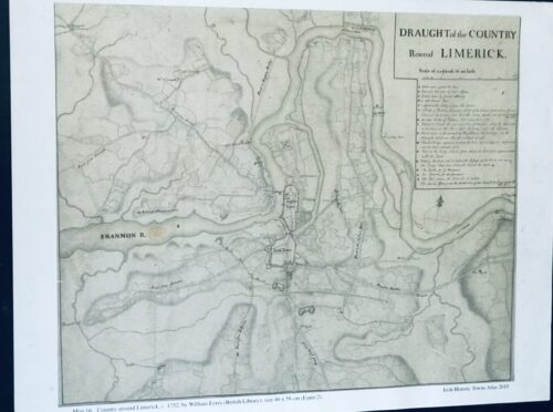
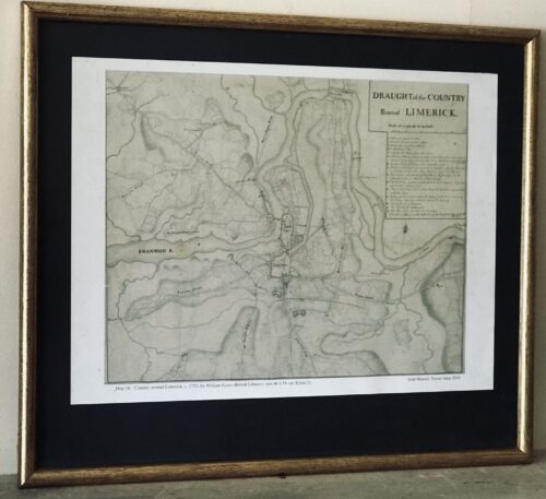
  • 42cm x 48cm  Limerick Fascinating Draught plan of the country around Limerick taken in 1752 by William Eyres Map Maker - the scale is at 320 yards to one inch.
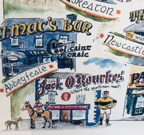
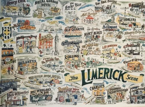
  • Absolutely superb, massive  poster from 1996 depicting some of the most famous past and present pubs of Co Limerick.A brilliant keepsakes for anyone with firm Limerick connections and memoris of the halcyon days of the 1990s! 85cm x 60cm
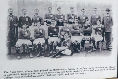
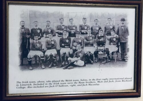
  • Team photograph of the Irish Rugby Team that played Wales in the first ever Rugby International ever held in Limerick in the County Cricket Grounds (now the Limerick Lawn Tennis Club) Ennis Road  on the 19th March 1898. 42cm x 30cm   Parnell St Limerick City  
Go to Top